For the longest time, I thought Langtang Region simply meant the Langtang Valley upto Kyanjin. When I went there in 2024, I got to know that Gosaikunda is also a part of the region.
And it was quite recently that I realised the Helambu region, the Tamang Heritage Trail, and even the Panch Pokhari area were also a part of the same region.
So, of course, there were numerous attractions spread among these regions that I was not aware of, which I will break down in this article. Yes, the valley trek is a major part of it, but that’s not all.
It may have taken me a while to understand the sheer spread and diversity within the Langtang region. But I hope to give you a clear map of the Langtang region and its major attractions through this article.
Natural Attractions of Langtang Region
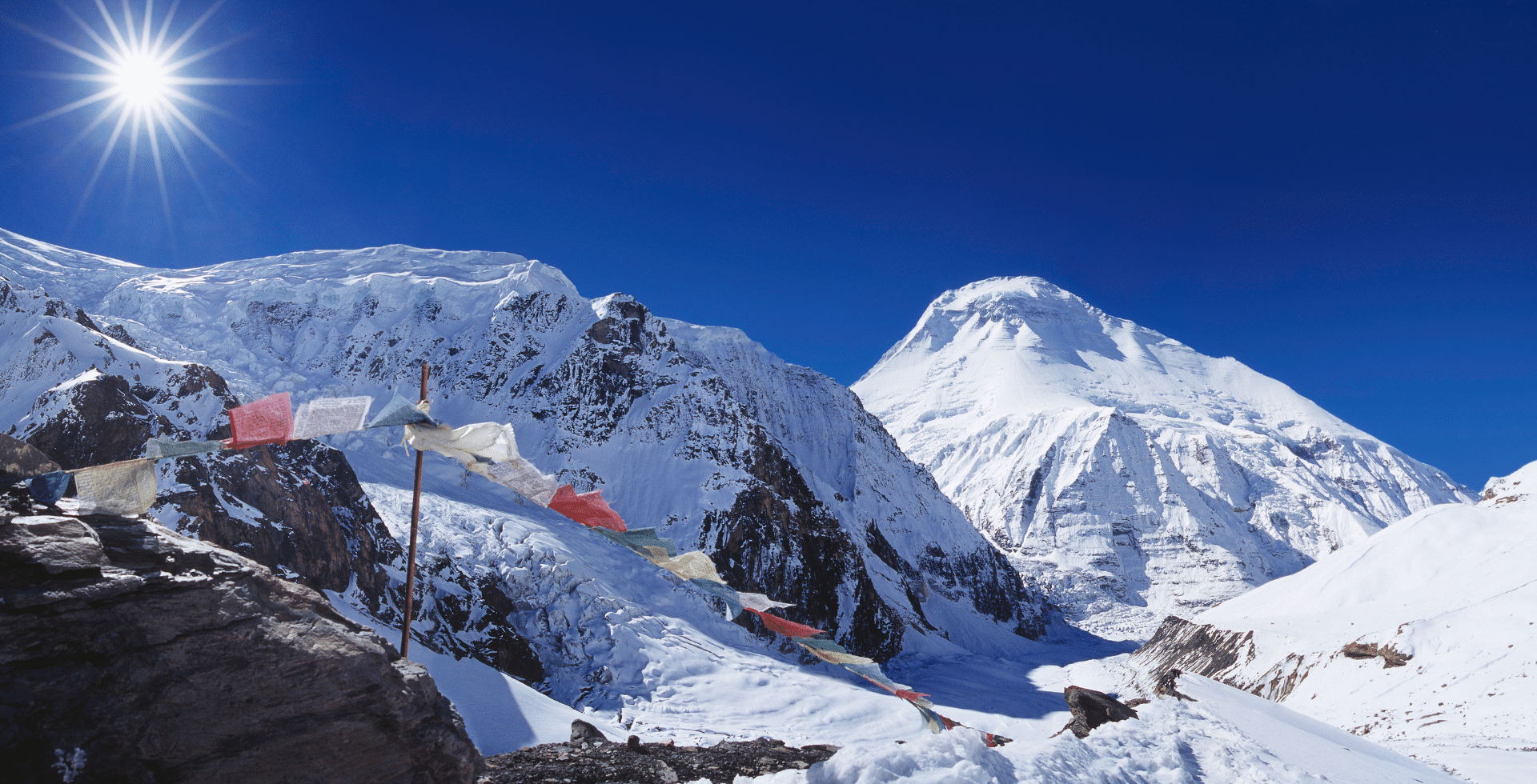
Langtang sits just north of Kathmandu within Langtang National Park, the first Himalayan national park of Nepal. From river valleys at about 1,300 m to peaks above 7,200 m, the region spans from subtropical forest to permanent snow.
At its heart is Langtang Himal, a compact sub-range whose valleys link naturally to Gosaikunda, Helambu, Panch Pokhari, and the Jugal Himal side.
Main Attractions of Langtang Valley Trek
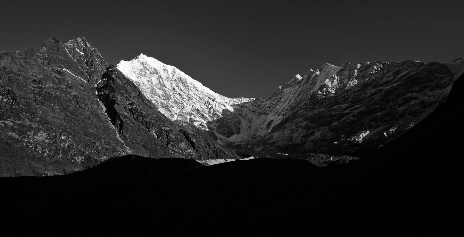
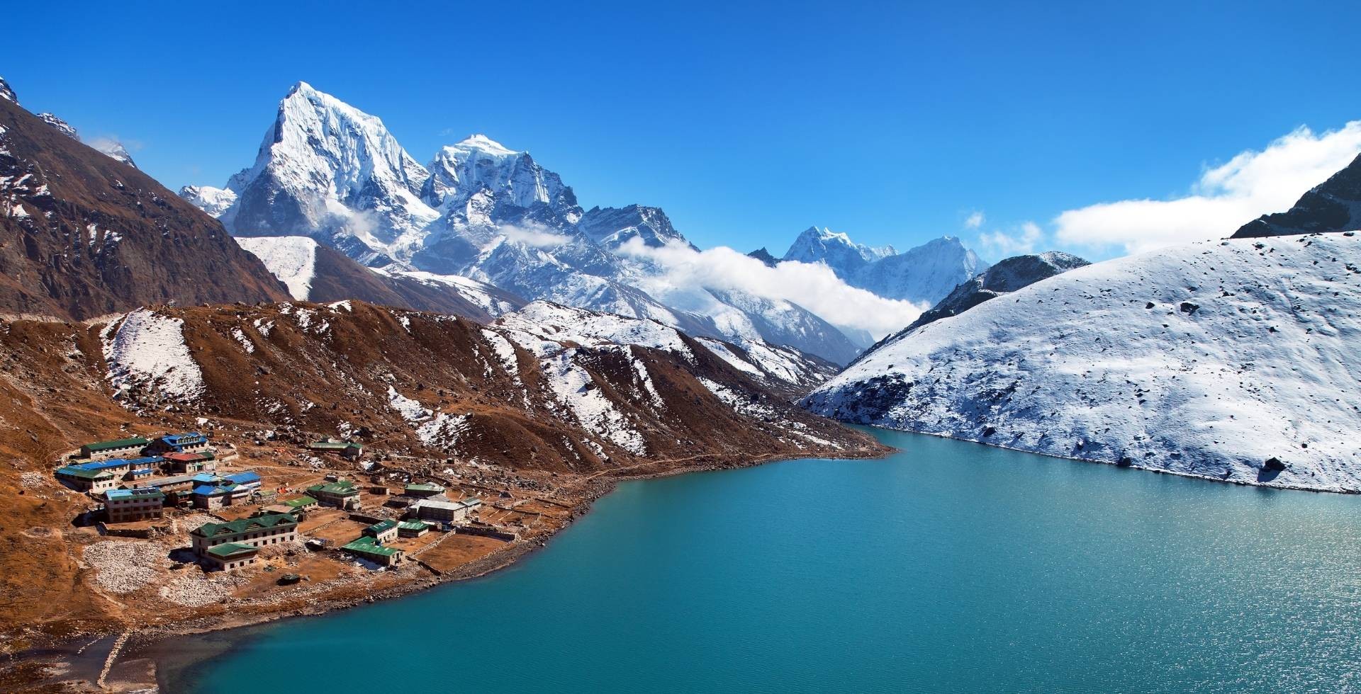
The Langtang Valley is often referred to as the “Valley of Glaciers.” In only a few days, you move from lush subtropical forest to a glacial basin ringed by ice and snow.
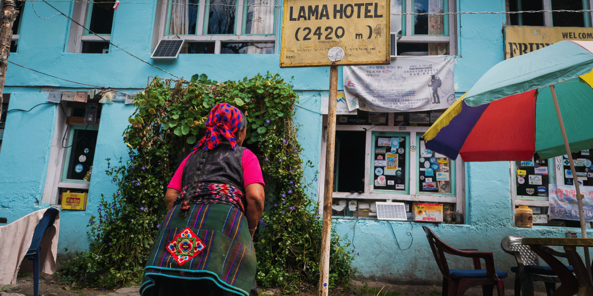
The trek to Langtang Valley begins at Syabrubesi (1,467 m) and follows the Langtang Khola through Lama Hotel, Ghoda Tabela, Langtang Village, and Mundu to Kyanjin Gompa at about 3,890 m.
Above Kyanjin, open yak pastures spread below the Langtang, Lirung, and Yala glaciers, with the rivers from them braided below.
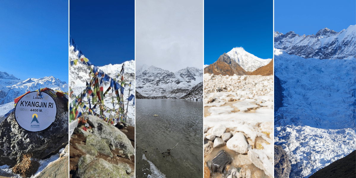
The Langtang Valley Trek is where you will see the famous viewpoints, glaciers, and vistas. We will discuss those later in the article as well, but here is the list of some of the main attractions of the Langtang Valley Trek:
- Kyanjin Ri
- Tsergo Ri
- Lirung Glacial Lake
- Langshisha Kharka
- Langtang Lirung Base Camp
- Lirung Glacier Viewpoint
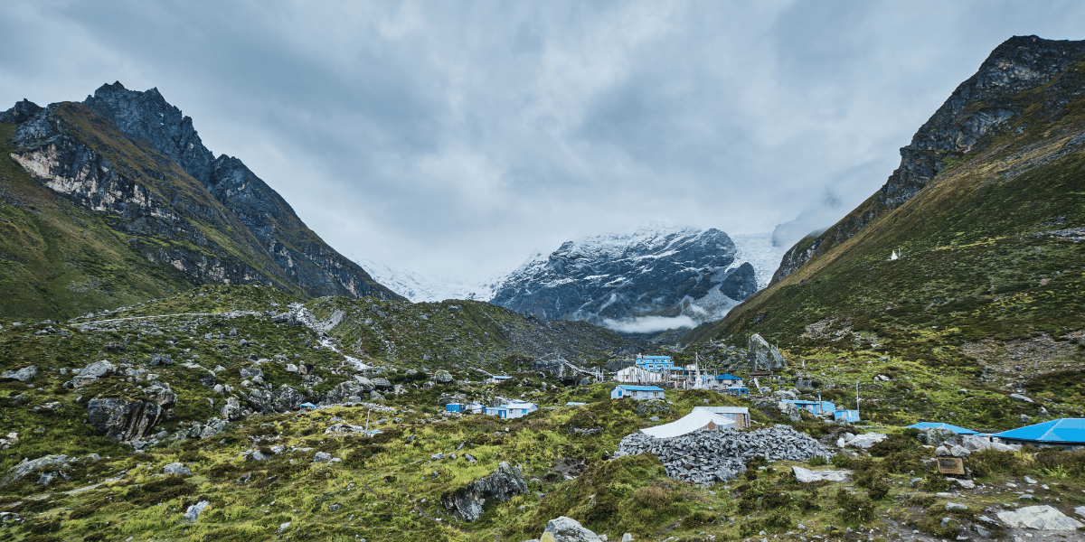
This valley is also one of Nepal’s most visible examples of earthquake recovery. Old Langtang village was mostly destroyed by the 2015 avalanche and has since been slowly rebuilt around what remained of the village.
The new settlement, memorial chortens, and revived lodges make the upper valley feel like a living amphitheatre of mountains, memory, and resilience rather than just another trekking corridor.
The valley sets the stage for everything else in the Langtang region, from its highest peaks and viewpoints to the daily lives of the Tamang communities. This is the collective view of how landscape and history come together here.
Mountains, Peaks, Viewpoints, and Ridges
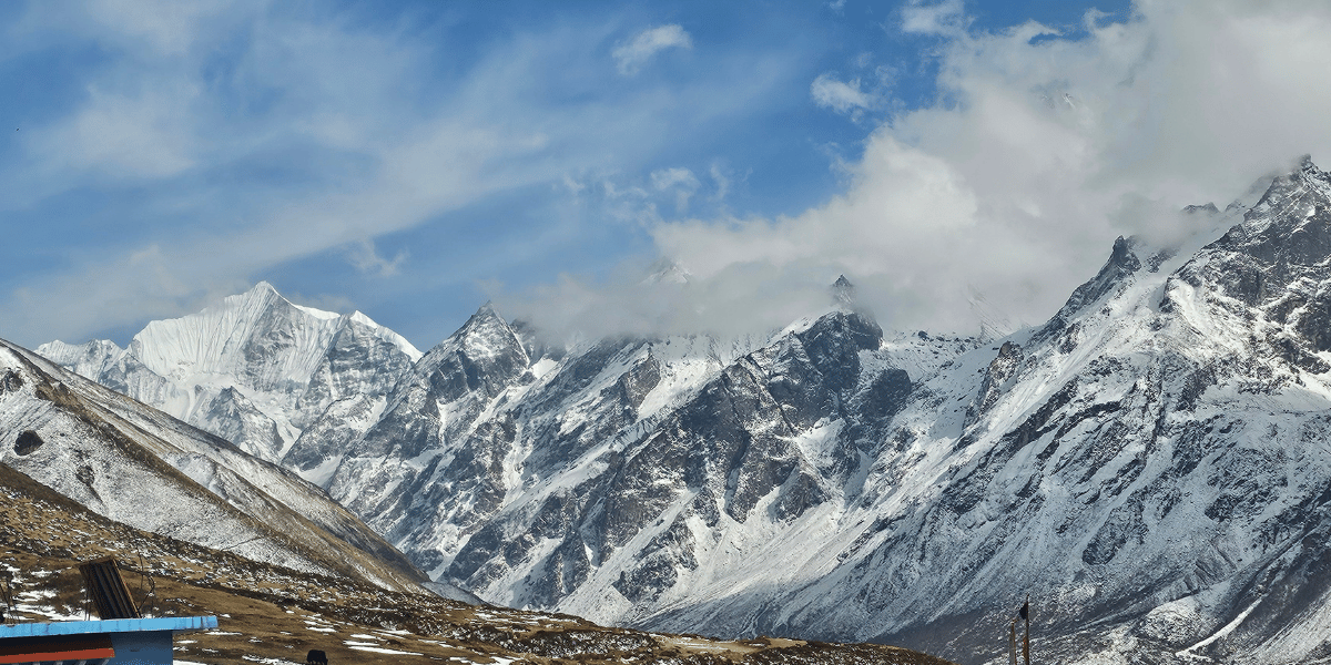
Langtang Lirung rises at 7,234 m and towers directly above Kyanjin Gompa on the western side. To the north-east, you will find Langtang Ri at 7,205 m on the Nepal-Tibet border.
Other prominent mountains include: Leonpo Gang (6,979 m), Dorje Lyakpa (6,966 m), Gurkarpo Ri (6,891 m), Pem Thang Karpo Ri (6,865 m), Bhairab Takura (6,799 m), Kimshung / Tsangbu Ri (6,781 m), Leonpo Gang East (6,733 m), Salbachum (6,707 m), Phurbi Chyachu (6,631 m), Pangri Goldumba (6,620 m), Kyunga Ri I (6,599 m), Ghenye Liru/Langtang II (6,571 m), and Yangri/Jugal (6,535 m).
Yala Peak (5,520 m) and Naya Kanga or Ganja La Chuli (5,863 m), are some of the accessible trekking peaks on the northern and southern skyline of Langtang.
These summits belong to the Langtang Himal sub-range, which sits between Ganesh Himal in the west and Jugal Himal in the east, fully enclosed within the Langtang National Park.
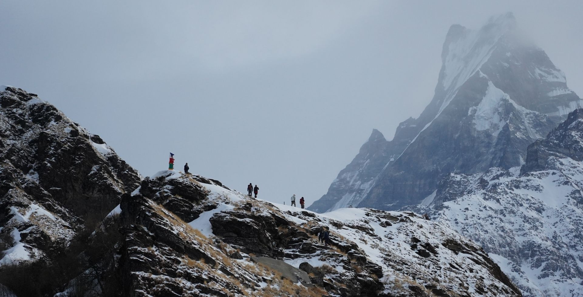
For trekkers, the most important “peaks” are often the viewpoints rather than the expedition summits, which are:
- Kyanjin Ri peak stands at about 4,700 m, the lower Kyanjin Ri is at 4,400 m and you will come across it on the way to Kyanjin
- Tserko Ri lies at 4,985 m. You can reach both of these on steep day hikes from Kyanjin that will then reward you with near-circular panoramas of Langtang Lirung, Langtang Ri, Ganchenpo, Dorje Lakpa, and the eastern Jugal side
- Further south, the Helambu ridges and the sacred viewpoint of Ama Yangri, around 3,771 m, give you a closer look at the Langtang and Jugal walls without needing to sleep as high as in the main valley.
Lakes of the Langtang Region
Three lake clusters are the definitive features of the broader Langtang region: the Gosaikunda basin above Rasuwa, the Panch Pokhari group on the Jugal flank, and numerous smaller glacial lakes in the upper Langtang valley.
Gosaikunda and the Sacred Lake Basin
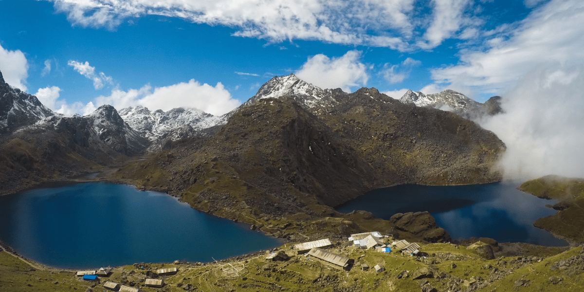
Gosaikunda Lake lies at 4,380 m on the southern side of Langtang National Park. It is one of Nepal’s most renowned pilgrimage lakes, revered by both Hindus and Buddhists.
The main lake is part of a basin comprising more than 108 high-altitude ponds, including Bhairav Kunda, Saraswati Kunda, Surya Kunda, Parvati Kunda, Dudh Kunda, and others, which spread across the Laurebina La ridge.
Treks usually approach either from Dhunche or Sundarijal via Chandanbari and Lauribinayak. The classic itinerary reaches the lakes in four to five trekking days from the road head in Dhunche.
In August, thousands of pilgrims walk up to the Janai Purnima and Gangadashara festivals, believing that bathing at Gosaikunda washes away sins and brings them closer to Shiva and other deities.
At other times, you share the trail mainly with trekkers and local herders, enjoying views that sweep from Langtang Lirung and Mt. Manaslu to Ganesh Himal and even parts of Annapurna on clear days.
Panch Pokhari below Jugal Himal
Panch Pokhari is a cluster of five sacred lakes at about 4,100 m on the north-eastern side of the Kathmandu basin.
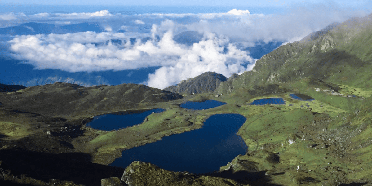
It sits at the base of the Jugal Himal chain in Sindhupalchowk. It is officially recognised as one of the Langtang National Park’s main features and one of the world’s highest wetlands.
The setting includes glacier-fed ponds, mixed conifer forest, and long, open ridges facing Dorje Lyakpa, Madiya, Phurbi Chyachu, and the Rolwaling range.
Unlike Gosaikunda, Panch Pokhari remains comparatively quiet outside the Janai Purnima fair, when Brahmin pilgrims gather to change the sacred thread (janai) they wear across their body.
The usual trek begins from Bhotang above Melamchi, climbs through Deurali and Nosyampati to Lauribina, then crosses into the lake basin before looping back down to the villages.
Most itineraries spend at least one sunrise on the ridge above the lakes, where you can watch clouds spill over the Jugal skyline and see both the Langtang and Rolwaling groups on a single horizon.
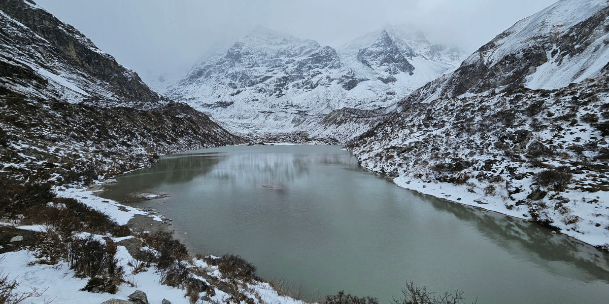
Lirung Glacial Lake and Micro-Hydropower
High above Kyanjin Gompa, beneath the snout of the Langtang Lirung Glacier, a small glacial lake at about 4,100 m has become the source of Nepal’s first hydropower plant built directly on a glacier-fed lake.
The Langtang Microhydro Electricity Project diverts water through a weir and penstock at the lake’s moraine to a powerhouse that generates around 100 kW. This supplies 24-hour electricity to roughly 120 households and lodges in Kyanjin and Langtang.
The scheme was completed a few years after the 2015 earthquake with support from the Kadoorie Charitable Foundation.
It is widely cited as a model for how glacial lakes can be managed both to reduce outburst-flood risk and to support mountain communities.
For those who are not able to reach the Upper or Lower Kyanjin Ri for any reason, this lake also provides a wide open view of the mountains and valley that you will surely remember.
When you hike up from Kyanjin towards the glacier, you can look across at the terminal moraine, see the penstock line, and grasp directly how melting ice, climate change, and local livelihoods are all tied together in this valley.
Other Notable Lakes
Beyond these headline sites, Langtang National Park and its buffer zone hold numerous smaller sacred and scenic lakes.
The Gosaikunda basin alone is believed to contain up to 108 individual ponds, many of which carry their own names and local stories, even if only a handful are regularly visited by trekkers.
The notable lakes include:
- Saraswati Kunda, Bhairab Kunda, Surya Kunda, Ganesh Kunda, Naag Kunda, etc in the Gosaikunda region
- Parvati Kunda in Gatlang
- Tin Pokhari cluster and Dudh Pokhari near Tilman Pass
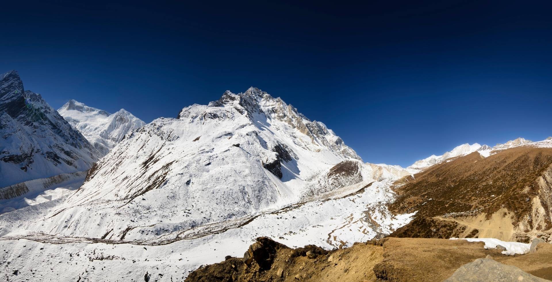
Glaciers and Ice Landscapes
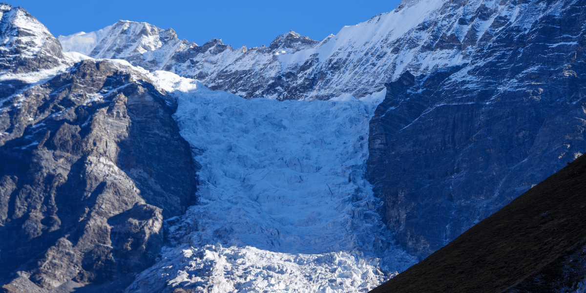
Glaciers shape the character of the Langtang region far more than you might notice at first glance. They carve the valleys you walk through, feed the streams you cross, and increasingly reveal how climate change is reshaping the mountains you come here to see.
- The largest glacier in the region is the Langtang Glacier, about 18 km long and covering roughly 50 square kilometres. It dominates the upper valley view from Mundu and Kyanjin.
- Just below Langtang Lirung, the Lirung Glacier forms a chaotic tongue of debris-covered ice.
- Yala Glacier hangs beneath Yala Peak on the northern skyline.
- Further east, Shalbachum and Langshisha glaciers stretch back into side valleys towards the Tibet border, shaping the dramatic amphitheatre that you see from Langshisa Kharka and from Tserko Ri.
- In the Jugal Himal sector, glaciers beneath Dorje Lakpa and Madiya feed the headwaters of the Indravati and other rivers that drain the Panch Pokhari and Helambu side.
Research shows that the Langtang Glacier has roughly doubled its thinning rates over the last four decades. Upper-glacier ice now wastes away at around 0.45 m per year because of warmer temperatures, debris patterns, and expanding melt ponds.
Yala Glacier has lost more than half of its surface area since the 1970s, prompting local guides and monks to symbolically hold a “funeral” for it in 2025 and to treat it now as a nearly dead glacier likely to vanish by around 2040.
For trekkers, these changes show up as higher glacier snouts, larger areas of bare moraine, and more erratic meltwater flows along the Langtang Khola.
Flora and Fauna
Langtang National Park protects a full elevational cross-section of central Himalayan ecosystems. From subtropical forests around 1,000 m to alpine meadows and rock above 4,000 m, the variety is remarkable.
Then climb through mixed oak and rhododendron, silver fir, hemlock, and the only native larch species in Nepal before reaching shrubby juniper and open grasslands near the tree line.
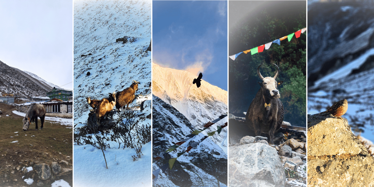
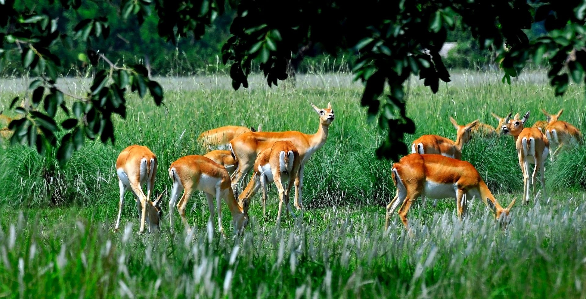
Official data records at least 46 mammal species and more than 250 bird species in the park.
Red panda, Himalayan tahr, musk deer, Himalayan black bear, wild dog, snow leopard, ghoral, serow, langur monkey, and rhesus macaque are among the most notable mammals.
Bird watchers come particularly for the Himalayan monal (impeyan pheasant), satyr tragopan, wood snipe, and the yellow-rumped honeyguide, all of which find good habitat in Langtang’s temperate and alpine zones.
As you walk, you will notice bamboo thickets between Syabrubesi and Lama Hotel, prime red panda habitat, and moss-draped hemlock near Ghoda Tabela and further up towards Kyanjin.
On the Panch Pokhari and Jugal side, forests thin out into mixed conifer and shrub, but you still have a good chance of seeing pheasants, small mammals, and soaring raptors along the ridges above 3,000 m.
Cultural Attractions of Langtang Region
The Langtang region is as much a cultural landscape as a natural one. Tamang, Sherpa, and Hyolmo communities live along the valleys and ridges that link Langtang, Gosaikunda, Helambu, and Panch Pokhari.
Trails cross old trade routes to Tibet, pass through villages rebuilt after the 2015 earthquake, and arrive at lakes and monasteries that are still active pilgrimage sites for both Buddhists and Hindus.
People and Daily Life
Most residents of Langtang Valley and the Tamang Heritage Trail are from the Tamang community. Their livelihoods centre on small-scale farming, yak and cattle herding, seasonal tourism, and occasional trade across the high passes.
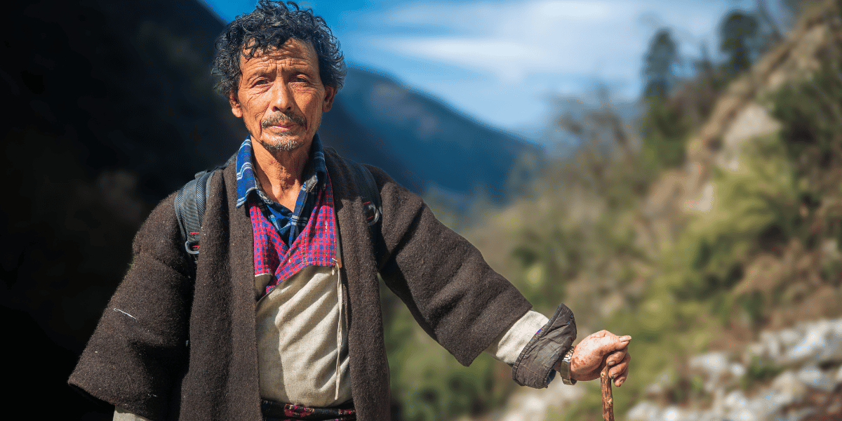
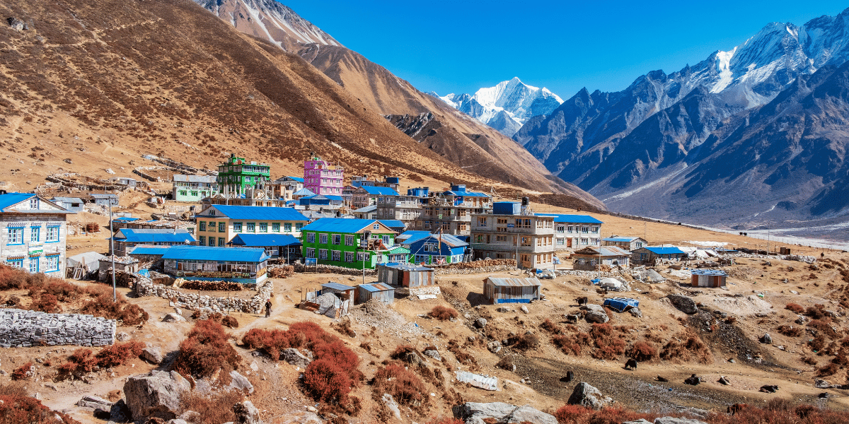
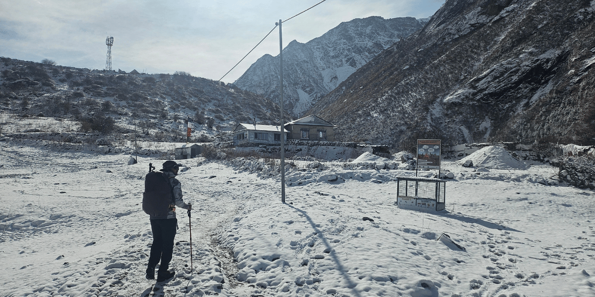
The traditional houses you will come across on your treks are usually stone-built with wooden roofs. But with better access to resources, “modern” houses are also common, especially around the lower trails.
You will find villages like Langtang, Mundu, Briddim, and Gatlang that combine Tibetan-Buddhist influences with distinct Tamang language and customs. This combination creates a culture that is unique to the people of these villages.
This combination is also why, on the Langtang Valley Trek, the Tamang culture resembles Sherpa/Tibetan culture more than the Tamang culture in the rest of the country.
In Helambu, the Hyolmo ethnicity is the most dominant. The Hyolmo people are typically Buddhist with a Shamanic background. They are described as a subgroup of the Sherpa community. They grow potatoes, radish, and apples on terraced hillsides while tending yaks and sheep on higher pastures.
In all these regions, the daily routine of the locals involves farm work, monastery rituals, and hospitality for trekkers on the Helambu Circuit and Ama Yangri routes.
On the Panch Pokhari side, Newar, Brahmin, Chhetri, and Gurung households dominate the lower settlements. Higher up, you will find seasonal herder shelters and small shrines closer to the lakes.
Ethnic Communities along the Trails
You will come across four broad cultural zones as you move through the region.
In the lower Trishuli and Bhote Koshi valleys around Syabrubesi, you mostly meet Tamang families who have historically traded salt and wool with Tibet via the Rasuwa Gadhi corridor.
Higher in Langtang Valley, Tamang culture remains strong but is blended with more direct Tibetan connections through monasteries, script, and ritual ties to Kyirong across the border.
On the Helambu Circuit, Hyolmo settlements such as Tarkeghyang, Melamchighyang, and Sermathang form a tight cluster of villages with shared monasteries, chortens, and seasonal festivals that knit the valley together.
On the Panch Pokhari and Jugal flanks, the mix is more varied, with Hindu Brahmin and Chhetri pilgrims converging seasonally with Buddhist Sherpa and Tamang herders who also revere Jugal peaks and lakes as abodes of local deities.
Festivals and Ritual Life in Langtang
Two of Nepal’s most popular and dramatic alpine pilgrimages take place inside Langtang National Park.
In Langtang Valley particularly, Gyalpo Lhosar, Dhukpa Chheju, Saga Dawa, Nyungne, and Langshisha Mela festivals are celebrated.
At Gosaikunda, thousands of devotees walk up in August for Janai Purnima and Gangadashara, bathe in the icy lake, and visit Shiva shrines built on the shore.
Local belief holds that Shiva created the lake by striking the ground with his trident to quench his thirst after drinking poison.
Similarly, at Panch Pokhari, Brahmin pilgrims gather at the same time to bathe and change their sacred thread (Janai). Local stories even describe each of the five lakes as a daughter of Shiva and Parvati.
In Helambu, Hyolmo communities celebrate Tibetan New Year (Gyalpo Losar), local mountain-deity rituals, and smaller monastery festivals tied to Ama Yangri and nearby guardian peaks.
Throughout the lower Langtang and Helambu sections, you also encounter wider Nepali festivals such as Dashain and Tihar in autumn, often marked by a mix of Hindu and Buddhist practices along the trekking routes.
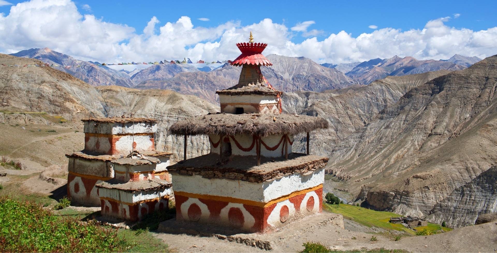
Monasteries and Sacred Architecture
Kyanjin Gompa sits at about 3,890 m in the upper Langtang Valley. It is the best-known monastery in the region and a spiritual focal point for the surrounding villages.
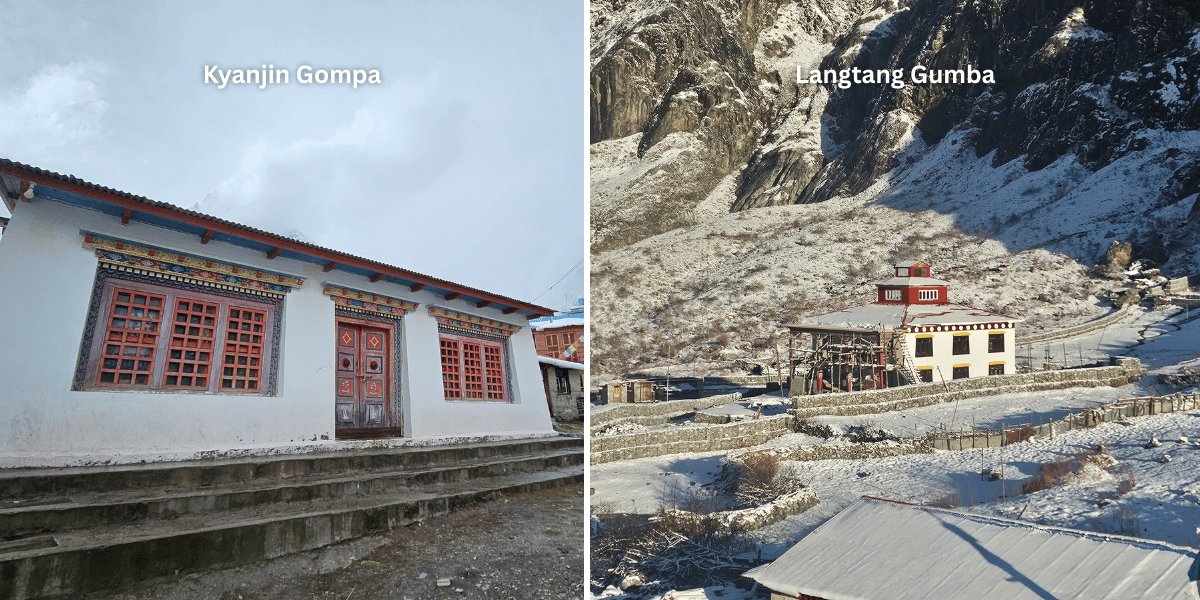
The gompa sits on a low rise above the main settlement, and its prayer halls, mani walls, and fluttering flags form a constant backdrop for acclimatisation walks and rest days in the valley.
Lower down, small monasteries and chortens around Langtang Village, Ghoda Tabela, and Briddim host rituals tied to local harvests, memorials, and protector deities.
On the Gosaikunda trail, Sing Gompa (in Chandanbari) is a historic monastery and rest stop renowned both for its religious role and for its traditional cheese factory.
You will find trekkers often stopping here to light butter lamps, listen to evening chanting, and sample yak cheese before climbing towards Lauribinayak and the Gosaikunda lakes.
In Helambu, monasteries at Melamchighyang, Tarkeghyang, and Sermathang, namely Tarke Ghyang Monastery, Chiri Gompa, Tashi Symbling Gompa, etc are some of the major cultural sites worth visiting along the Langtang-Helambu trekking link.
These monasteries bring you a lot closer to the Hyolmo culture and how they pray, stay grounded, and go about their days. You will also get to experience the depth of their faith woven into their daily lives.
Beliefs Tied to Landscapes
Langtang as a whole is often described in local narratives as a beyul, or hidden valley, blessed by Guru Rinpoche (Padmasambhava) and protected by mountain deities associated with peaks like Langtang Lirung and Ama Yangri.
On the Panch Pokhari side, local interpretations see Jugal Himal as a king of white snow and Lakpa Dorje as a guardian of the five ponds, tying the high ridges and lakes into a Buddhist-Hindu sacred geography.
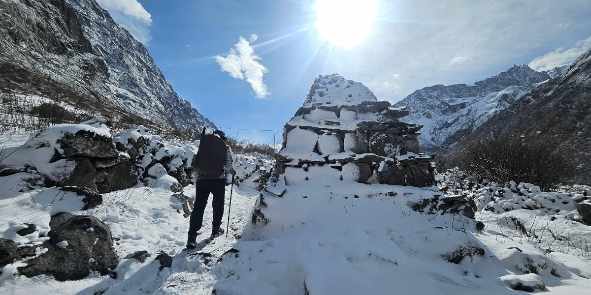
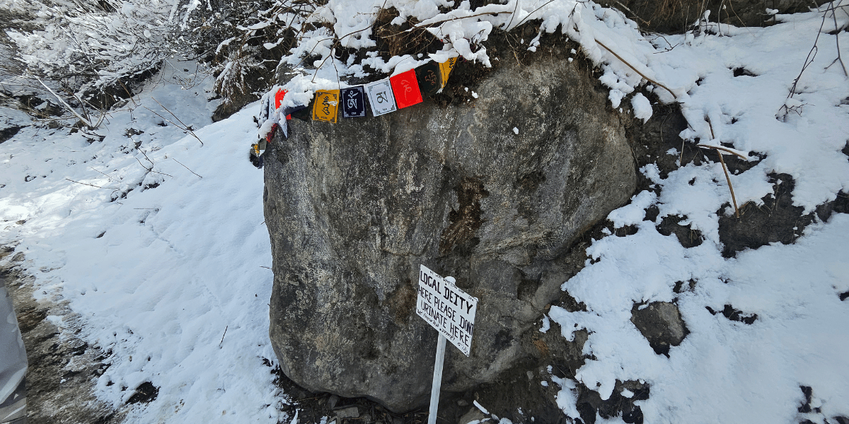
These beliefs are not, of course, abstract. They show up in the way trails are lined with mani stones, the way ridgelines are crowned with prayer flags, and the way locals discuss accidents and good fortune as reflections of whether the local deities are pleased or disturbed.
For you as a visitor, walking slowly around chortens clockwise and greeting gompas respectfully is a simple way to move in harmony with the people who live here.
Architecture across the Langtang Corridor
Stone houses with small windows, slate or tin roofs, and wooden beams dominate Langtang, Helambu, and Panch Pokhari villages.
The stone houses are built strongly enough and in clusters so that they shed snow and withstand strong winds.
In many settlements, you still see traditional village layouts with houses around small courtyards, grain storage above the animal shelters (Goth), and a kitchen that doubles as the family shrine.
After the 2015 earthquake, many buildings in Langtang Valley and the Bhote Koshi corridor were rebuilt using more reinforced concrete and metal while trying to retain traditional facades, window frames, and carved details.
In Helambu and Panch Pokhari approaches, newer lodges and teahouses often stand side by side with older houses. With increasing number of tourists, new accommodation facilities are also being built with traditional designs and model strengths.
Looking at these mixed settlements throughout the region gives you a clear sense of how tourism is reshaping the architecture without fully erasing older forms.
Hidden Gems in the Langtang Region
Away from the classic Langtang Valley-Gosaikunda-Helambu triangle, the broader region has so many more quiet villages, ridges, and side valleys where you can walk for hours with only a few locals for company.
Many of these places still fall under Langtang National Park or its buffer zone, so they share the same wildlife, forest types, and distant peak views as the main trails.
Tamang Heritage Trail and Nagthali Ghyang
North of the Trishuli and below the main Langtang Valley, the Tamang Heritage Trail links villages such as Gatlang, Tatopani, Thuman, and Briddim in a loop. Parts of this trail lie just outside Langtang National Park, but it still feels like a natural extension of the Langtang region.
The Tamang Heritage Trail focuses on the homestays, hot springs, and village life rather than high passes. But that does not mean you won’t enjoy the stunning views of mountains all around you.
From Nagthali Ghyang, a ridge-top pasture sitting at around 3,165 m, you get sweeping views of Langtang Lirung, Langtang Ri, and Ganesh Himal without needing to climb to the altitudes of Kyanjin Ri or Tserko Ri.
This ridge is one of the easiest high viewpoints in the region and is particularly beautiful at sunrise and sunset when the peaks shift from shades of pink to gold.
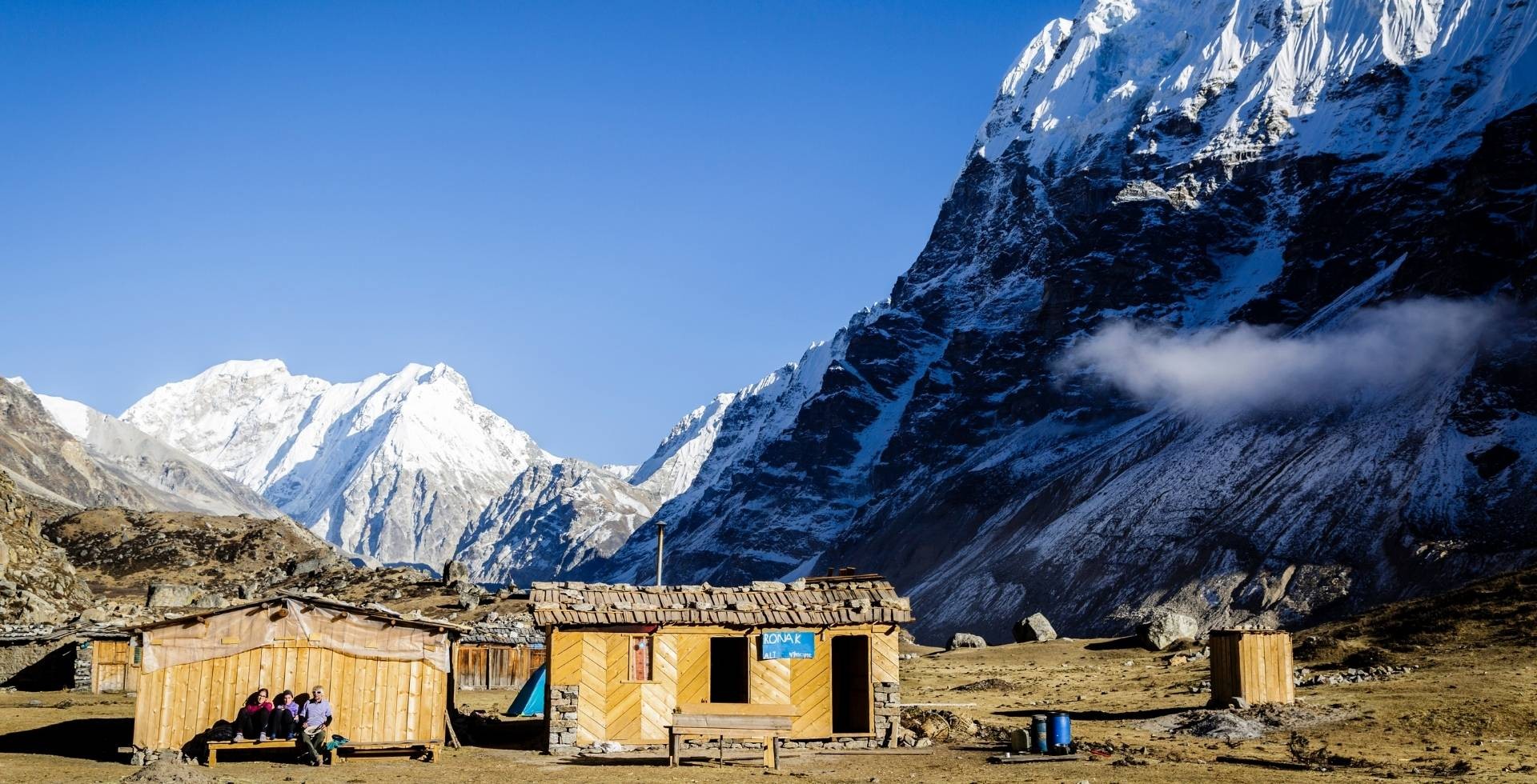
Jugal Himal and Off-the-Beaten-Path Camping
On the eastern side of the region, Jugal Himal rises between Langtang and Rolwaling. It remains one of central Nepal’s least visited mountain groups.
In a multi-day camping trek, you visit Jugal Himal Base Camp at around 4,700 m, link Panch Pokhari with Bhairav Kunda, and traverse long rhododendron-clad ridges with constant views of Dorje Lakpa, Phurbi Chyachu, and other sharp Jugal peaks.
Because infrastructure is limited, Jugal Himal routes are best suited to trekkers comfortable with tents, longer days, and fewer facilities.
In return, you get a level of silence and wilderness that is hard to find on more famous trails. For many, this is the side of the Langtang-Helambu landscape that still feels truly wild.
Ama Yangri in Helambu
In Helambu, Ama Yangri is one of the best underrated additions to the Langtang story. It is situated at an elevation of 3,772 m above sea-level.
Often, you will find locals describing Ama Yangri as the mother protector of the Helambu region, which gives the hike a stronger spiritual feel than a simple viewpoint walk.
It is shorter and more approachable than the bigger high-altitude treks. From Kathmandu, you can complete this trek in just 3 days.
But the summit still feels greatly rewarding because the trail passes through quiet forests and a landscape with a strong sense of pilgrimage.
From the top, the view of Langtang, Jugal, and Ganesh Himal and, on clear days, the silhouettes of the Gaurishankar and Rolwaling ranges are unfolded all around you.
If you visit Ama Yangri in March/April, you will actually be welcomed with blooming rhododendrons throughout the trail and mountains at the summit.
Best Time to Visit the Langtang Region
You can technically trek in Langtang, Helambu, and the Jugal flank in all four seasons. But conditions, colours, and crowds change a lot over the year.
Spring (March-May) and autumn (September-November) offer you the most stable weather and clearest views. Monsoon and winter are quieter but, of course, more physically and technically demanding.
Spring (March to May)
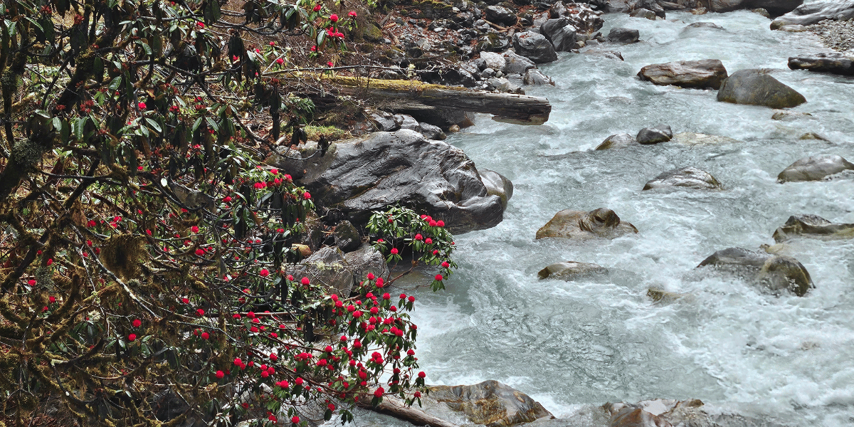
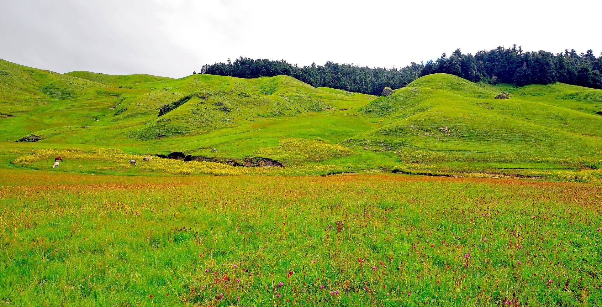
Spring brings moderate daytime temperatures and cold but manageable nights. A burst of rhododendron and wildflower blooms colours the forests between roughly 2,000 and 3,500 m.
Visibility is usually good in the mornings, with clean snow lines on the peaks and just enough haze later in the day to soften the light for photography.
This is an excellent time for Langtang Valley, Gosaikunda, and Helambu itineraries that combine forests and high viewpoints. If you love wildlife, watch for red pandas, Himalayan tahr, and active birdlife in the park.
Rhododendron tunnels on the Gosaikunda and Helambu trails, plus green yak pastures above Langtang Village and on the way to Tserko Ri, feel especially lush in April.
Because the season is popular, lodges on the main Langtang and Gosaikunda routes can fill quickly. You should definitely make advance bookings or arrange for flexible timing.
You might experience afternoon clouds and occasional pre-monsoon weather, so starting early and having good rain gear helps you make the most of clear mornings.
Best-looking attractions in spring:
- Langtang Valley to Kyanjin Gompa, Kyanjin Ri, and Tserko Ri
- Gosaikunda lakes and Lauribinayak ridge
- Helambu Circuit ridges and Ama Yangri viewpoints
- Panch Pokhari ridgeline with snow still on Jugal and Rolwaling peaks
- Tamang Heritage Trail forests around Tatopani and Nagthali Ghyang
Summer / Monsoon (June to August)
The monsoon brings heavy rain, saturated greenery, and frequent clouds. You will find muddy and slippery trails, leeches in lower forests, and there is an increased risk of landslides on some steep sections.
If you are comfortable with rain, this is one of the most atmospheric times to experience Langtang’s forests, waterfalls, and village life.
On top of that, you will have to share the trail with far fewer trekkers except in the Gosaikunda Panch Pokhari regions. Since Janai Purnima falls in August, the trails to the sacred lakes are very crowded with pilgrims.
The mountains appear in dramatic windows when clouds lift, and the fields around Helambu and lower Langtang are intensely green.
Poor visibility, disrupted road access, and slippery paths are the main challenges. Some high passes or ridge sections may be unsafe after heavy rain, so always be informed on latest trail conditions from your guide or locals.
Leeches are a constant annoyance below about 2,500 m, especially on routes that cut through dense undergrowth.
Best-looking attractions in monsoon (with caution):
- Lower Langtang Valley up to around Langtang Village for forest and river scenes
- Tamang Heritage Trail and village homestays, focusing on culture over long views
- Helambu’s lower villages and farm terraces, rather than the highest ridges
- Janai Purnima pilgrimages to Gosaikunda and Panch Pokhari, if you are well prepared for crowds, mud, and fast-changing weather
Autumn (September to November)
Autumn is widely considered the prime trekking season in Nepal. Post-monsoon clarity, stable temperatures, and long sequences of blue-sky days are what make it so popular.
Daytime temperatures are neither too hot nor too cold at mid-altitudes, and nights are crisp but manageable with good gear, especially below about 4,000 m.
This is the best time for big panoramas from Kyanjin Ri, Tserko Ri, Lauribinayak, Ama Yangri, and Panch Pokhari ridges. Air is clear, and distant peaks stand out sharply.
You will have a great time, as trails are generally in good condition after the monsoon. And more importantly, autumn also coincides with major Nepali festivals such as Dashain and Tihar in villages along the approaches.
This popularity means most major trails will be busy, and some sections may still show monsoon damage in the form of washed-out bridges or small landslides.
We highly recommend that you prebook lodges in hubs like Syabrubesi, Langtang Village, Kyanjin, and Lauribinayak in advance or at least have a flexible start date during peak weeks.
Best-looking attractions in autumn:
- Langtang Valley Trek, including side trips to both Kyanjin Ri and Tserko Ri
- Combined Langtang-Gosaikunda-Helambu through Laurebina La
- Panch Pokhari and Jugal Himal camping treks
- Helambu Circuit and Ama Yangri viewpoints
- Ruby Valley extensions with clear Ganesh Himal views
Winter (December to February)
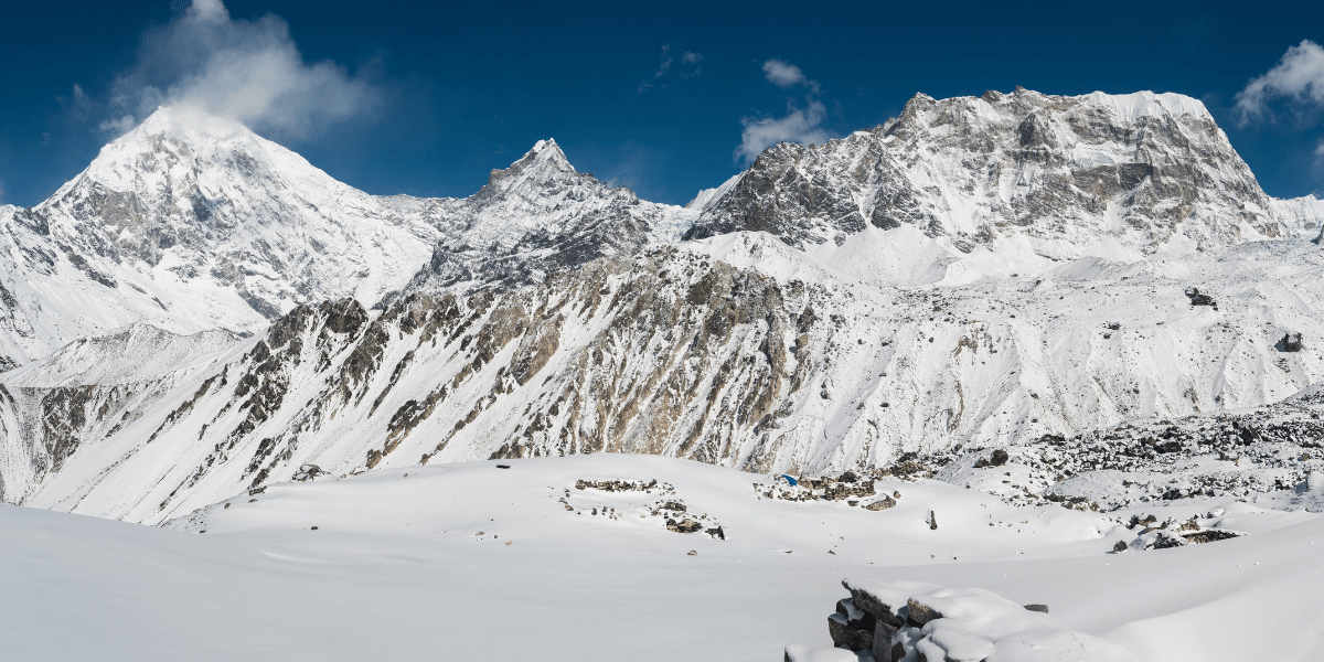
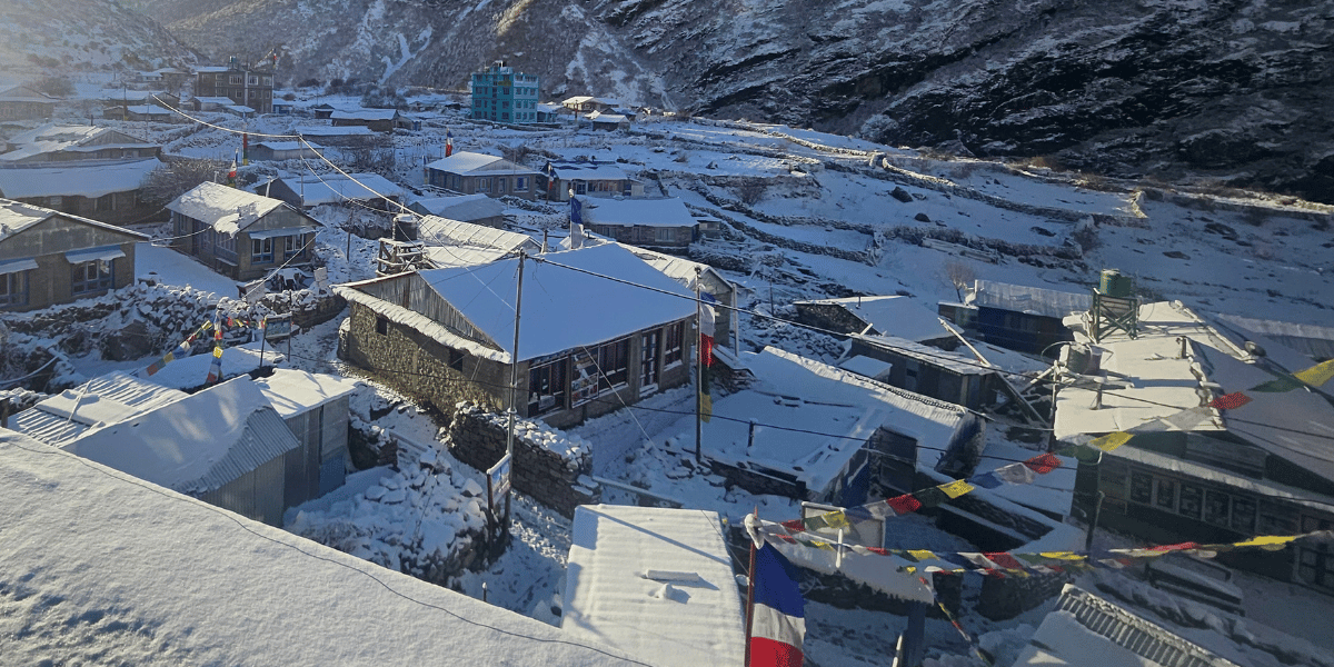
Winter brings colder temperatures, regular snowfall at higher elevations, and a quieter atmosphere on most trails.
Daytime temperatures at mid-altitudes can still be pleasant in the sun, but nights around and above Langtang Village are frequently well below freezing.
When skies are clear, winter provides some of the sharpest mountain views of the year. Fresh snow outlines ridges from Ganesh Himal across Langtang to Jugal.
Trails are far less crowded, and lower Helambu and Tamang Heritage villages in particular feel calm, with more time for conversations around stoves in the evenings.
Snow or ice can make passes like Lauribinayak and other high points and passes unsafe without proper equipment. So, make sure you have the necessary equipment and gear before committing to winter treks.
Very cold nights and shorter daylight hours require warmer gear, flexible planning, and an experienced local guide who understands winter trail conditions.
Best-looking attractions in winter (for prepared trekkers):
- Langtang Valley up to Kyanjin Gompa when lodges are open
- Lower Helambu villages and short Ama Yangri hikes in good weather windows
- Tamang Heritage homestays
- Gosaikunda and Panch Pokhari lakes for a frozen ambience
How to Enjoy the Langtang Region Attractions
Exploring Langtang properly means balancing your time between valleys, lakes, ridges, and villages so that you experience both the landscapes and the people who live in them.
The region ranges from subtropical forest to high alpine terrain, so you also need to plan and prepare carefully for altitude, weather, and trail conditions.
Practical Tips for Your Visit
Planning your Langtang trip wisely can make the difference between a rushed slog and a deep, rewarding experience in the valley. Give yourself enough time, respect the altitude, and treat the region as locals’ home rather than just a backdrop.
- Give yourself enough days: Even the classic Langtang Valley trek is best done over 7-10 days so that you can climb gradually from Syabrubesi to Kyanjin and add at least one acclimatisation day before attempting Kyanjin Ri or Tserko Ri.
- Be wary of Altitude Sickness: As a trekker, you should also be aware of the signs of altitude sickness (such as headache or nausea) and descend if symptoms persist, as this is critical for safety at high elevations.
- Adapt and rest: If you want to link Gosaikunda and Helambu along with Langtang valley, plan for around 12-16 days. This way, your body will have enough time to adapt before you sleep above 4,000 m.
- Include buffer days: Langtang’s changing demand requires one or two buffer days in your itinerary for weather, minor illness, or trail delays. Having too tight a schedule usually results in more harm than good.
- Carry enough cash: In this region, card payments are usually unavailable or unreliable. You can find an ATM in Kyanjin Gompa, but there is a possibility it won’t work. So, cash is the only reliable payment method, and it’s recommended to carry at least the expected expense amount with you in cash.
- Carry power banks: Due to common network issues and potential power outages on trail sections and some settlements, carrying power banks or electricity-related backups is a must for a smooth trip.
- Stay informed on weather conditions: Over the years, studies and local experience both show clear patterns of more erratic snowfall, heavier downpours, and shifting monsoon patterns. These conditions make high passes unsafe and sometimes can be hazardous.
- Support the local economy: Remember that you are walking through places people call their homes. Staying in locally owned lodges, eating local food of the region, and hiring local guides and porters all help boost the local economy and, in the long run, the quality of life for the locals.
- Be present and attentive: Simple gestures like learning a few local phrases, walking clockwise around chortens, and asking before photographing people or religious objects will show your respect towards Langtang and its people.
Itineraries and Packages that Cover Key Attractions
The Langtang region is big enough to satisfy almost every kind of trekker but compact enough that you can fit more than one route in a single trip.
You can hike the Langtang Valley for a week and loop through Helambu and Ama Yangri for a short getaway. Or, you can stretch it into a two‑week traverse that links Gosaikunda, Panch Pokhari, and the Tamang‑Heritage side.
Below I have listed some of the major itineraries that you can pick from. All of these itineraries are curated by our specialists who know the region inside out. You can view them and decide which is the one that will take you to your favourite Langtang attractions.
Typical duration: 10 days from Kathmandu and back (with arrival/departure included)
Route: Syabrubesi – Lama Hotel – Ghoda Tabela – Langtang Village – Mundu – Kyanjin Gompa, with optional side hikes to Kyanjin Ri and Tserko Ri.
This is the classic glacier‑and‑village experience. You start at 1,467 m, walk through forests and villages, and walk up to open yak pastures beneath the Langtang and Lirung glaciers.
The trek is moderate in difficulty, so earlier preparation and a sensible pace help you enjoy the valley properly instead of racing through it. If you are an experienced trekker, then you can even attempt the short Langtang Valley itinerary.
If you have only a short window, or if high‑altitude trekking is not an option, the Langtang Valley Helicopter Tour gives you a taste of the valley in just a couple days.
Flights leave from Kathmandu, fly north, and land near Kyanjin Gompa, giving you time to walk around, see the Langtang Lirung Glacier, and feel the ambience without walking for days.
Total flight time is typically 1.5–2.5 hours, and you can choose to stay in Kyanjin overnight and return by helicopter the next day. It won’t replace the slow rhythm of a trek, but it’s a stunning way to see Langtang if you’re pressed for time.
Gosaikunda Lake Trek
Typical duration: 7–13 days, depending on whether you start from Dhunche, Thulo Syabru, or directly from Kathmandu.
Route: Dhunche/Thulo Syabru – Shin Gompa (Chandan Bari) – Laurebina La – Gosaikunda.
Highest point: Gosaikunda at 4,380 m, with Laurebina La around 4,610 m if you continue towards Helambu.
This trek sits at the crossroads of religion and landscape. You hike through monastery‑serviced villages, walk through a high pass, and arrive at a lake basin that feels like a temple.
Langtang–Gosaikunda–Helambu Traverse
If you want to soak up the Langtang region in one long thread, you can link Langtang Valley, Gosaikunda, and Helambu into a continuous 15–17‑day loop.
- Go up the Langtang Valley to Kyanjin Gompa,
- Retrace part of the way to Thulo Syabru,
- Climb to Gosaikunda, cross Laurebina La (4,610 m),
- Drop into Helambu through Ghopte, Tharepati, Tarkeghyang, and Sermathang before ending near Sundarijal or Melamchi.
In one journey you enjoy glaciers and high peaks in Langtang, sacred lakes around Gosaikunda, and the terraced hills and Hyolmo culture of Helambu. If you prefer a shorter version, the Langtang–Gosaikunda Lake Trek is a 13‑day package that leaves out the Helambu detour.
Duration: 14 days for the full circuit, with shorter options possible.
Route: Syabrubesi – Gatlang – Tatopani – Thuman – Briddim – Nagthali Ghyang and back.
This itinerary focuses on villages, homestays, and hot springs rather than long, high‑pass hikes. You soak in the Tatopani hot springs, stay with Tamang families, and hike up to Nagthali Ghyang for a clean panorama of Langtang and Ganesh Himal.
It works well as a warm‑up trek, a family‑friendly route, or a cultural add‑on after a tougher valley trek.
Typical duration: 6–12 days, depending on style and side trips.
Route: From Bhotang above Melamchi, through mixed settlements of Sherpa, Tamang, and other communities, and up to the five lakes at about 4,100 m on the Jugal side.
This trek is often less crowded and more remote than the Gosaikunda corridor, which is revered at the same spiritual levels. Aside from the pilgrimage treks in Auguest, you won’t find many trekkers along the route.
That being said, the ridge above the Panch Pokhari lakes shows the Langtang, Jugal, and Rolwaling peaks in one long horizon. This is a good choice if you want a high‑altitude experience with less foot traffic.
Duration: 6–10 days, depending on side hikes and whether you include Ama Yangri.
Route: Sundarijal – Chisapani – Kutumsang – Tharepati – Tarkeghyang – Sermathang – Melamchi Pul Bazaar.
This route is short, culturally rich, and visually satisfying. You walk through bamboo forests, terraced farms, and tight clusters of stone houses, meet Hyolmo families, and pass several monasteries that feel like quiet anchors in the valley.
For views, you can extend the route to Ama Yangri (3,771 m), a sacred peak that looks directly over Langtang, Jugal, and Ganesh Himal.
Final Thoughts: Are the Langtang Attractions Worth It?
Taken together, Langtang Valley, Gosaikunda, Panch Pokhari, Helambu, and the Jugal Himal flank form one continuous mountain story.
Rivers rise from retreating glaciers, forests shelter red pandas, lakes act as living temples, and villages are rebuilding while holding on to Tamang and Sherpa traditions.
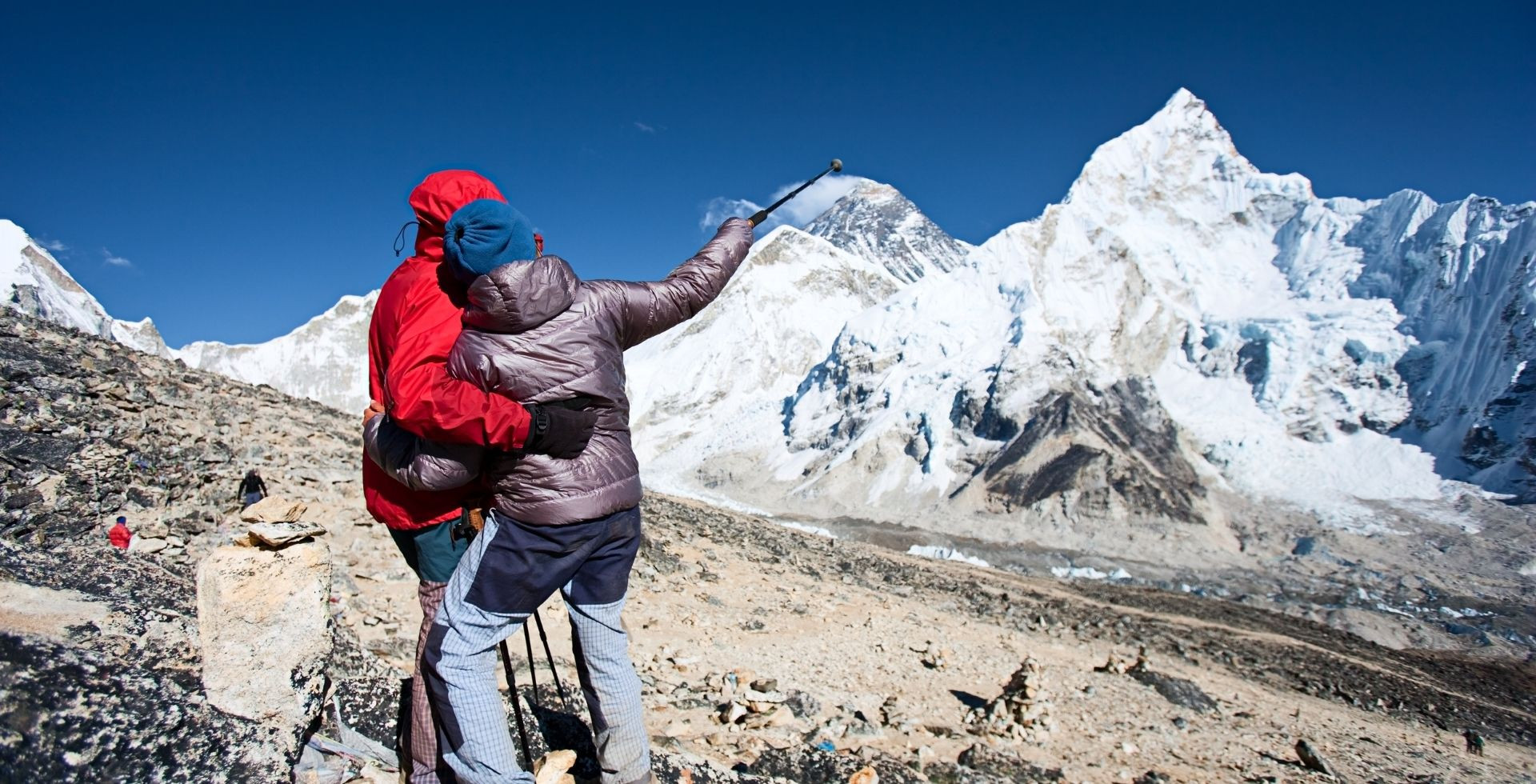
Very few regions this close to a capital city let you move so quickly to high Himalayan viewpoints where you can watch sunrise over a wall of 7,000-metre peaks.
Whether you come for a short Helambu loop, a classic Langtang Valley trek, a demanding Gosaikunda-Panch Pokhari traverse, or a quick helicopter morning to Kyanjin, the combination of landscapes, wildlife, culture, and living spiritual sites tends to linger.
Plan carefully, get your permits, walk respectfully, and give the region enough of your time. That is the best way to make sure it stays with you in a way that feels deep and personal rather than rushed and superficial.
Langtang trek won’t cost you bucks and can even be done independently. All you need are the right preparations. But if you’re looking for a tour operator to handle all the logistics while you stay focused on your trek, I hope you’ll give our team at Altitude Himalaya a chance.


 Karuna Bhattarai