Upper Dolpo Circuit Trek for Nepali
“This is a fine chance to let go, to “win my life by losing it,” which means not recklessness but acceptance, not passivity but nonattachment.” ― Peter Matthiessen, The Snow Leopard
“This is a fine chance to let go, to “win my life by losing it,” which means not recklessness but acceptance, not passivity but nonattachment.” ― Peter Matthiessen, The Snow Leopard
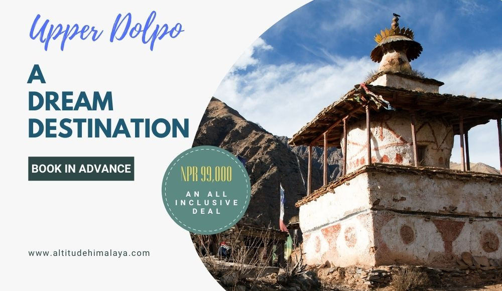
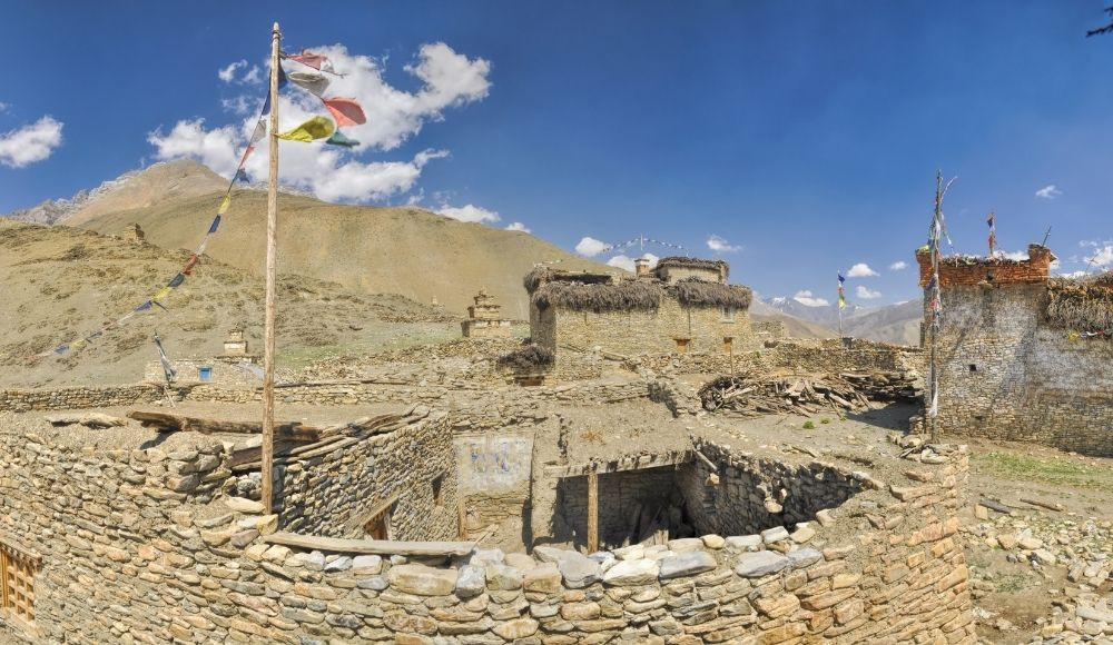
Upper Dolpo Circuit Trek is one of the most remote and unexplored trekking routes in the northern fringe of midwestern Nepal. Having a similar resemblance to that of the Tibetan plateau, Upper Dolpo, also known as Inner Dolpo, is a best-preserved place in its natural form. Untouched by modernization, Upper Dolpo is the least transposed and culturally rich area of Nepal.
Upper Dolpo observes less rainfall due to its trans-Himalayan properties. It lies beneath the Kanjiroba (6,883m) and Dhaulagiri (8,167m) Himalayan range, which blocks the wind that causes rainfall, resulting in an arid climate for most time of the year.
Dolpo region is an untouched beauty. The beautiful waterfalls, lakes and mind-blowing tales of remote areas with distinct and unique cultural practices are the major attractions of the trek. Dolpo remained pristine, even today, due to the rural foundation, area restriction to conserve the cultural artefacts and isolated lifestyle in the extremely rural settlement.
Upper Dolpo Circuit Trek is a camping based trek that requires extensive preparation and professional guide support to complete. Though the road development is seen in some lower areas of Dolpo, it is still a place that has an incredible amount of remoteness and offers tremendous joy to the explorers.
Trekking in the Upper Dolpo circuit is a lifetime experience. A diverse range of landscapes and natural sceneries that is very distinct from the other trekking areas of Nepal can be explored in the Dolpo area.
Traversing through some parts of the Great Himalayan Trail in the higher elevations, the Dolpo area has a lot of experiences to offer. The remote hospitality, mountains and trans-Himalayan geography alongside a wide range of flora and fauna make the Upper Dolpo trek a beautiful mist in paradise.
The Upper Dolpo Circuit Trek has been popular in Nepal for decades. But due to the difficulty, cost of the trek and the time it requires make it a bit inaccessible for a lot of trekkers that arrive or are in Nepal. Upper Dolpo, also known as the last enclave of pure Tibetan culture in Nepal, is a wonderful place to be if you want to explore the sparse vegetation and arid geography.
Upper Dolpo has a uniqueness in it. The zeal to explore the pristine Shey Phokdundo and Bon culture that is preserved at its best has now developed an embarkment of Nepalese trekkers in this area. Dolpo is now becoming adventure fueled youths top choice in Nepal. So, we have especially designed this Upper Dolpo Circuit Trek for Nepali to facilitate the Nepali trekkers in the Dolpo region of Nepal.
The Upper Dolpo Circuit Trek for Nepali is an all-inclusive trek that is designed to be cost-efficient and convenient for Nepalese trekkers. Every necessary thing is included to meet the trek demands during the trek.
The trek begins with a flight to Nepalgunj from Kathmandu and another domestic connecting flight takes you to the beautiful Juphal village in the Dolpa district. Juphal is also the trek's beginning point. From Juphal, the trail passes through the banks of Phoksundo Khola reaching Chhepka, Jharana Hotel, and Ringmo reaching Phoksundo lake. After exploring the oligotrophic Shey Phoksundo, trekking further towards Phoksundo Khola Camp, Low Camp and High Camp is very astonishing. During this segment of the trek, the Juniper forested trails are beautiful and the astounding Kanjirowa Range is spectacular.
After reaching Phoksundo High Camp, crossing the first pass of the trek, Kang La Pass is beautiful and takes you to Shey Gompa. Shey Gompa carries a huge religious significance in the Dolpo region. The further trekking passes through some of the beautiful high altitude places such as Namdung, Saldang, Komas, Shimen, Tinje, Khola Camp and Tokyu. While reaching Saldang, a pass named Saldang La is the most beautiful one. The amazing landscapes and mind blowing scenery of Dolpo are best explored from this pass. It is highly admired for its spectacular panoramic sceneries and arid beauty.
From Tokyu, Dho village lies about three hours away. It is one of the beautiful and well-developed villages in the Dolpo region.
From Dho Tarap, trekking towards Toltol, Lasicap and Dunai will take you to the Juphal village. A flight from Juphal to Nepalgunj concludes the trek. Though the trek takes about 21 days to complete and is challenging, Upper Dolpo Circuit Trek is imperative to understand the remote lifestyle and is a life-changing experience for novice trekkers.
Upper Dolpo, in the northwestern part of Nepal, is a wonderful place to be, it becomes more fascinating if you are willing to explore more of the cultural dimensions and its fascinating history that begins with the disintegration of the Tibetan empire during the 10th century to the today’s fragmented human settlement with a huge influence of Tibetan Buddhism and Bonpo religion in the arid landscapes.
Dolpo lies in the tributaries of the autonomous Lo Kingdom, which is also known as Upper Mustang, both of which came under the territory of Nepal after the state-building initiation during the 17th century. The Mustang district borders Dolpo in the east; Mugu and Jumla in the west; Jajarkot, Rukum west and Rukum east in the south; and the autonomous region of China - Tibet in the north.
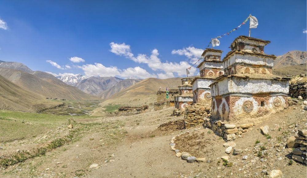
Dolpo boasts unique geography, culture and climate. The beautiful mountain passes, arid and barren geography, scattered and fragmented human settlements and high altitude lakes are the major attractions of this area.
Dolpo is also the largest district of Nepal with an area of roughly 8000 sq. Km. Despite having tremendous natural beauty, Dolpo is one of the most remote and preserved places in Nepal.
Dolpo is a pristine beauty and a restricted area that requires a special permit for foreigners to visit. This area was only opened for outsiders to visit in 1989 and the trekking trail was developed to facilitate trekkers to explore the authenticity of the remote domain of Nepal. Upper Dolpo Circuit Trek offers a comprehensive peek into the unspoiled geography and rural lifestyle and is highly admired for the amazing landscapes and centuries-old Tibetan traditions. The hand-irrigated green pastures, snowclad Himalayas, some oligotrophic lakes and high mountain passes are best seen during the Dolpo trekking in Nepal.
Though the lifestyle of people in the Dolpo region is highly dependent upon husbandry and agriculture, nowadays, with the movement of niche tourists, tourism is becoming a source of income in this area. Dolpo is isolated and thus politically and economically not progressive. Before the 1960s, Dolpo was politically autonomous under the Kingdom of Nepal, however, it was not until that period, the officials realized the importance of connecting Dolpo to the National radar for the inclusive growth of infrastructure and lifestyle in the mountains.
Agro Pastoralism, often referred to as a culture of migration for the livelihood and livestock survival to adapt to the natural climate is one of the interesting parts to explore in the Upper Dolpo area. Though the agro-pastoral culture is rare nowadays, seasonal migration is still a thing in some places.
Although the Dolpo region lies in the Nepalese territory, the Tibetan influence in the lifestyle of inhabitants and their dependence on the Tibetan area to maintain their livelihood can be seen in higher areas of Dolpo.
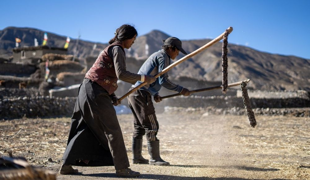
Sandwiched between the Political chaos of their own country Nepal and Tibet, the lifestyle of Dolpo people went offshore from the overall development in contrast to other areas of Nepal. Now, the cultural significance of the Dolpo is very huge, but the reliance on regional growth seems insufficient. And tourism is now becoming the healing factor that might be fruitful for the enhancement of the livelihood of the people of Dolpo. The lifestyle of Dolpo is remote, but the sort of hospitable smiley faces of people here captivate the souls of trekkers.
The experiences as a child, growing up in Dolpo, is best described by a spirited girl Dorje Lama in her memoir, ‘Yak Girl’, where she describes her life as a Dolpo girl. This book is an insightful detail of a remote lifestyle where she quotes her experience after exposing herself to the outside world as, “Their apartment was cosy and spotless, with soft beds and shiny furniture. In their living room was a tall lamp that I was completely fixated on because I was so unfamiliar with electrical objects. It was bright like the sun and I could turn it off and on by pulling a string attached to the lamp. ‘Why don’t we have such a light in Dolpo?’ I wondered. In Dolpo, we only had butter lamps for light. If the butter lamp got blown out by a breeze or got knocked down, we sat in the dark until someone found a match. Once again I feel like I have landed on another planet”.
The Dolpo indeed has a remote lifestyle, but the beauty it offers has incredible experiences to offer. The culture and lifestyle are similar to those that date hundreds of years back. After the introduction of trekkers to this area after opening up for trekking a few decades back, Dolpo is progressing and the people in this area are constantly striving to improve the hospitality and also working to sustain the cultural and natural beauty, for which this last paradise is known.
The beauty of Dolpo is also described in their work by some world-renowned creators. Peter Matthiessen describes his experiences in Dolpo in his book ‘The Snow Leopard’ as a spiritual journey and a life-changing experience. Also, in another instance, the movie ‘Himalaya’ directed by Éric Valli depicts the lifestyle and culture, and the astonishing geography in the Dolpo of Nepal.
Upper Dolpo is one of the most beautiful places to explore in Nepal. The itinerary for the Upper Dolpo Circuit Trek for Nepali is provided here.
You will be flying to Nepalgunj to begin your trek to the Upper Dolpo region. The Kathmandu Nepalgunj flight takes about 40-45 minutes to reach. Today, you will be staying in Nepalgunj and enjoy the scenery around. This day is the only luxury you will be getting as the next day, you will be getting to the remote areas where finding even a nice coffee shop is out of the question.
An early flight from Nepalgunj will take you to Juphal. The ethereal beauty of Dolpa begins from Juphal itself. Juphal is a remote place. But there are a few hotels and shops from where you can get food and water. Since the flight is early, the astonishing Sunrise over the mountains is the best sight to see.
Upon landing in Juphal, you will be driving towards Chhepka village. After a drive of 30-45 minutes, you will reach Suligad Ghat. From Suligad Ghat, the trek starts. It takes about 6 hours of trekking to reach Chhepka from Suligad Ghat. The wooden bridges and Juniper forests last throughout the trail. This day, you will be trekking for the entire time in and around the banks of the Suligad river. Upon reaching Chhepka, you will have camping on the banks of the Phoksundo river.
|
Flight |
KEP-DOP (Nepalgunj-Juphal) |
|
Flight Time |
30 minutes |
|
Starting Point |
Juphal [2475 m/ 8120 ft] |
|
Ending Point |
Chhepka [2678 m/ 8786 ft] |
|
Connectivity |
Phone |
|
Trek Distance |
12 KM |
|
Trek Time |
About 6 hours |
|
Highest Elevation |
Chhepka [2678 m/ 8786 ft] |
|
Elevation Gain |
[203 m/ 666 ft] |
|
Accommodation |
Camping |
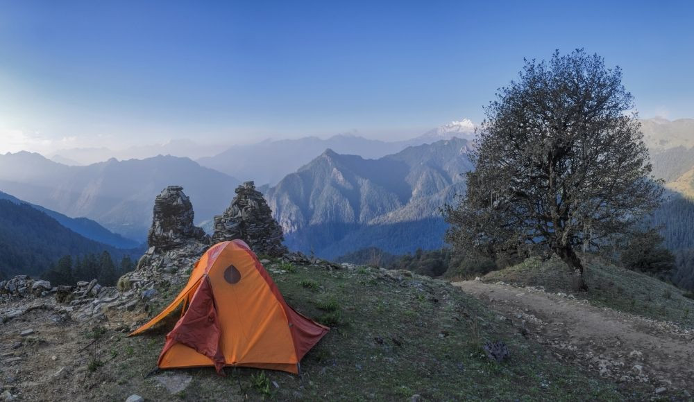
After early sunrise and breakfast in the camp, you will be heading towards Jharna Hotel. It is one of the easy trails in the Upper Dolpo Circuit trek. This day too, you will be trekking alongside the banks of Phoksundo Khola. The forested trail and the river banks last throughout the trek this day. Passing along the Suligad river and villages such as Rechi and Samduwa, you will reach Jharna Hotel. Jharna Hotel lies just ahead of a confluence of Pugma Khola and Phoksundo Khola.
The total distance of the trek is about 13 Km and it takes about 6-7 hours to trek this day. Upon reaching Jharana Hotel, you will prepare a camp for overnight stay.
|
Starting Point |
Chhepka [2678 m/ 8786 ft] |
|
Ending Point |
Jharna Hotel [3130 m/ 10269 ft] |
|
Connectivity |
No |
|
Trek Distance |
13 KM |
|
Trek Time |
6-7 hours |
|
Highest Elevation |
Jharna Hotel [3130 m/ 10269 ft] |
|
Elevation Gain |
[452 m/ 1482 ft] |
|
Accommodation |
Camping |
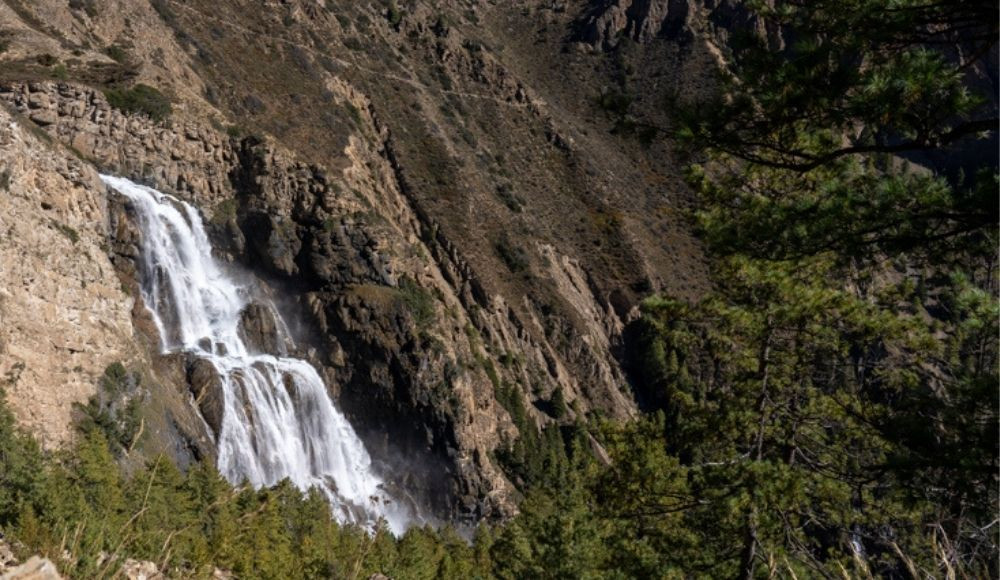
After breakfast in the early morning, you will begin trekking towards Ringmo. From Jharna Hotel, you will be trekking passing through the Chunuwar, Polam, winter village reaching Ringmo Gaon. Ringmo Gaon lies just beside Phoksundo Lake, so, this day you can explore the amazing Phoksundo Lake this day. The trekking this day is about 5 Km.
Phoksundo Lake is situated at an elevation of 3600 m. It is one of the most beautiful oligotrophic lakes of Nepal in the higher elevations. While trekking to the Ringmo village, you can also explore a large waterfall and the Phoksundo Khola. You can also explore the village and visit Bonpo Gompa which lies beside Phoksundo Lake. Overnight stay in a camp in Ringmo.
|
Starting Point |
Jharna Hotel [3130 m/ 10269 ft] |
|
Ending Point |
Ringmo [3641 m/ 11945 ft] |
|
Connectivity |
Phone, Internet |
|
Trek Distance |
5 KM |
|
Trek Time |
5-6 hours |
|
Highest Elevation |
Ringmo [3641 m/ 11945 ft ] |
|
Elevation Gain |
[511 m/ 1676 ft] |
|
Accommodation |
Camping |
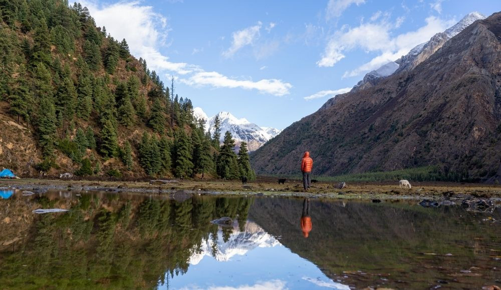
Early in the morning, you can explore the mind-blowing sunrise in Phoksundo lake. After breakfast in the camp, trekking for the day will begin. You will trek towards Phoksundo Camp this day. It takes about 5-6 hours to complete the trek.
In the early time, you can go to the view tower and explore the scenery around. Getting nearer to the forest camp will reward you with the pristine natural beauty of the Phoksundo area. This is also the day, from where the Upper Dolpo begins. Trekking in the banks of Phoksundo Khola and exploring the exquisite Kanjirowa Himal is one of the best parts of the day. In the evening, prepare to camp for the overnight stay.
|
Starting Point |
Ringmo [3641 m/ 11945 ft] |
|
Ending Point |
Phoksundo Camp [3630 m/ 11909 ft] |
|
Connectivity |
No |
|
Trek Distance |
10 KM |
|
Trek Time |
5-6 hours |
|
Highest Elevation |
Phoksundo Camp [3630 m/ 11909 ft] |
|
Elevation Gain |
[-11 m/ -36 ft] |
|
Accommodation |
Camping |
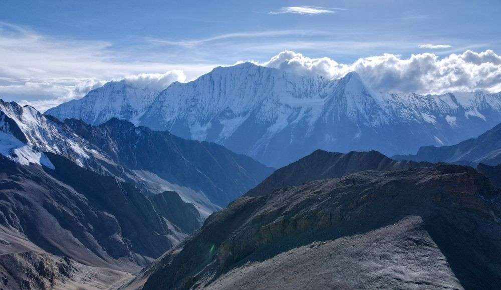
After breakfast in the camp, you will begin trekking towards the low camp. Low Camp lies at an elevation of 3750 m above sea level and offers panoramic views of the Kanjirowa Himal range. The trail is mildly uphill, mostly plain and passes through the forested area.
The elevation gain is low, so, it will be easier to adapt to the changing altitude here. There’s no need for acclimatization as you won’t be gaining high altitude and mostly you can enjoy the scenery around. It takes about 5-6 hours to complete the trek this day. In the evening, prepare camp for the overnight stay.
|
Starting Point |
Phoksundo Camp [3630 m/ 11909 ft] |
|
Ending Point |
Low Camp [3750 m/ 12303 ft] |
|
Connectivity |
No |
|
Trek Distance |
8.5 KM |
|
Trek Time |
5-6 hours |
|
Highest Elevation |
Low Camp [3750 m/ 12303 ft] |
|
Elevation Gain |
[120 m/ 393 ft] |
|
Accommodation |
Camping |
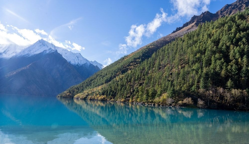
This day, you will be trekking to the High Camp. It is also the most difficult day of the trek. The uphill climb is very strenuous and you will gain about 750 m reaching 4500 m altitude. The trail this day is in the banks of Tuk Kyaksa Khola. After an uphill climb, you will start to lose sight of forests and greenery. Mostly the arid landscapes are seen around the trek. The Sunset is spectacular from the High Camp. In the evening, you will prepare the camp for an overnight stay at this place.
|
Starting Point |
Low Camp [3750 m/ 12303 ft] |
|
Ending Point |
High Camp [4500 m/ 14763 ft] |
|
Connectivity |
No |
|
Trek Distance |
2 KM |
|
Trek Time |
5-6 hours |
|
Highest Elevation |
High Camp [4500 m/ 14763 ft] |
|
Elevation Gain |
[750 m/2460 ft] |
|
Accommodation |
Camping |
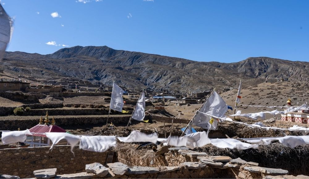
After early breakfast at the High Camp, you will begin trekking towards Shey Gompa. This day, you will have to pass through the Nagdalola mountain pass. It is one of the difficult passes in the Upper Dolpo Circuit Trek. The crystal mountain seen during the trek is one of the most sacred places for the Bonpo followers. This area is considered sacred by the inhabitants due to its religious significance. Many inhabitants circumambulate Crystal Mountain during religious occasions.
It takes about 6 hours to complete the trek this day. There are several gompas in this area among which the Red Gompa, which lies in the cliff and is considered to have a history that dates back to the BC period. It takes one hour to reach Red Gompa from Shey Gompa. In the evening, you will prepare camp in the Shey Gompa for an overnight stay.
|
Starting Point |
High Camp [4500 m/ 14763 ft] |
|
Ending Point |
Shey Gompa [4348 m/ 14265 ft] |
|
Connectivity |
No |
|
Trek Distance |
11 KM |
|
Trek Time |
5-6 hours |
|
Mountain Pass |
Nagdalo La Pass [5350 m/ 17552 ft] |
|
Highest Elevation |
Nagdalo La Pass [5350 m/ 17552 ft] |
|
Elevation Gain |
[-152 m/-498 ft] |
|
Accommodation |
Camping |
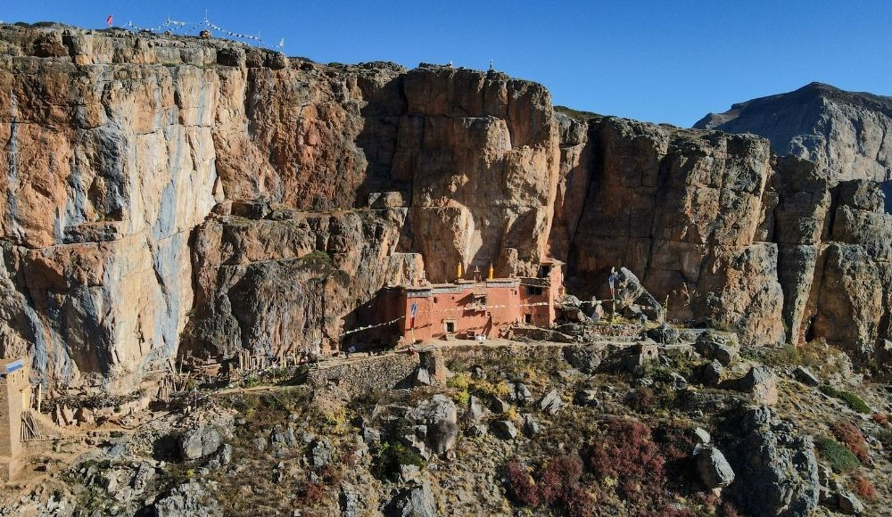
After early breakfast at the camp, you will begin trekking towards Namgung. The landscape is mostly barren and arid this day. Trekking beside the cliff and crossing the Shey La Pass is an exciting part of the trek. The trek this day is moderately difficult and there are chances to witness snow leopards in this area.
It takes about 5-6 hours to complete the trek. The altitude gain is low this day and mostly you will be trekking in the barren and plain area. In the evening, camping will be beside the Gompa in Namgung.
|
Starting Point |
Shey Gompa [4348 m/ 14265 ft] |
|
Ending Point |
Namgung [4360 m/ 14304 ft ] |
|
Connectivity |
No |
|
Trek Distance |
11 KM |
|
Trek Time |
5-6 hours |
|
Mountain Pass |
Shey La Pass [5094 m/16712 ft] |
|
Highest Elevation |
Shey La Pass [5094 m/16712 ft] |
|
Elevation Gain |
[12 m/ 40 ft] |
|
Accommodation |
Camping |
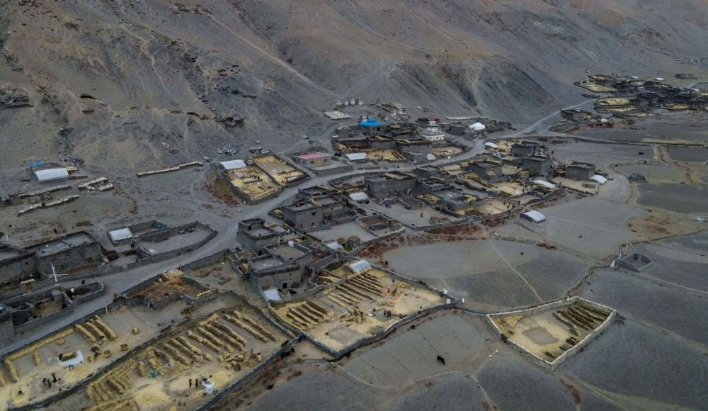
After breakfast in the morning, you will begin trekking towards Saldang Village. This day is one of the most beautiful days of the Upper Dolpo trek. This day, you will be crossing Saldang La Pass. Saldang is the largest village of Dolpo area with school, health post and some other basic facilities. The Saldang La Pass is the best pass of the entire trek that offers panoramic views of barren landscapes and mindblowing sceneries around the mountain valley. In the evening, you will prepare camp in the Saldang village.
|
Starting Point |
Namgung [4360 m/ 14304 ft] |
|
Ending Point |
Saldang [3770 m/ 12368 ft] |
|
Connectivity |
Phone |
|
Trek Distance |
7 KM |
|
Trek Time |
5-6 hours |
|
Mountain Pass |
Saldang La Pass [4700 m/15419 ft] |
|
Highest Elevation |
Saldang La Pass [4700 m/15419 ft] |
|
Elevation Gain |
[-590m/-1935 ft] |
|
Accommodation |
Camping |
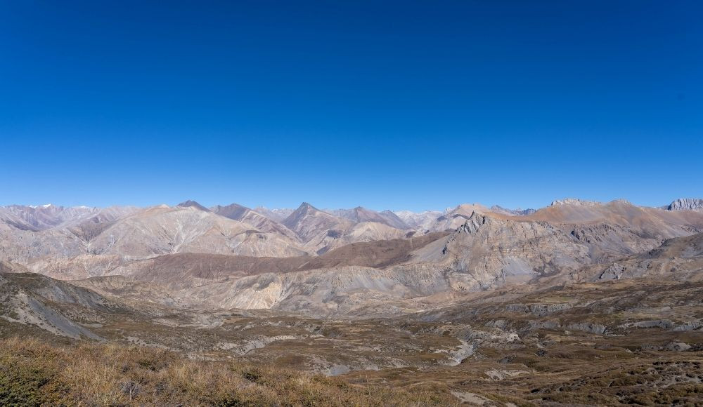
After breakfast in the camp, you will begin the trek towards Komang. Passing through the Tangkhor, you will cross the Komang La Pass reaching Komang. The trek is mostly uphill and barren. It takes about 6-7 hours to complete the trek. You will gain about 400 m elevation. In the evening, you can explore the Komang village and prepare the camp for the overnight stay.
|
Starting Point |
Saldang [3770 m/ 12368 ft ] |
|
Ending Point |
Komang [4210 m/13812 ft] |
|
Connectivity |
Phone |
|
Trek Distance |
8.5 KM |
|
Trek Time |
5-6 hours |
|
Mountain Pass |
Komang La Pass [4500 m/14763 ft] |
|
Highest Elevation |
Komang La Pass [4500 m/14763 ft] |
|
Elevation Gain |
[440 m/1443 ft] |
|
Accommodation |
Camping |
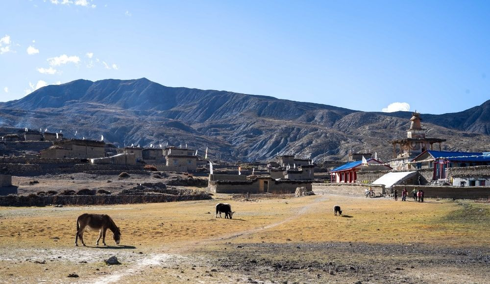
In the morning after breakfast, you will begin trekking towards Shimen village. You will pass through Dun Goth, lake, and Nang La pass finally reaching Shimengaon. The Nang La Pass is also popular as Shimen La Pass and is one of the most astonishing parts of the trek to explore. There are several gompas and monasteries in Shimen to explore. Also, the culture and lifestyle of locals is an interesting part to witness in the village area. In the evening, you will prepare camp for the overnight stay.
|
Starting Point |
Komang [4210 m/13812 ft] |
|
Ending Point |
Shimen [3880 m/12729 ft] |
|
Connectivity |
Phone |
|
Trek Distance |
9 KM |
|
Trek Time |
5-6 hours |
|
Mountain Pass |
Nang La [4375 m/14353 ft] |
|
Highest Elevation |
Nang La [4375 m/14353 ft] |
|
Elevation Gain |
[330 m/1082 ft] |
|
Accommodation |
Camping |
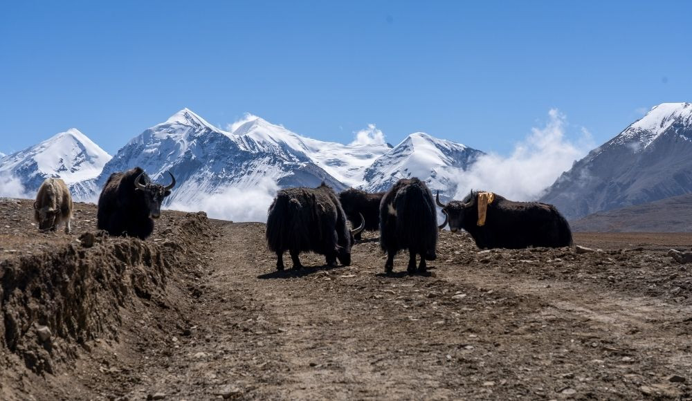
After breakfast at the camp in the morning, you will begin trekking towards Tinjegaon. This day too, you will gain some elevation reaching 4110 m above sea level. Passing through Shimen Gompa, Mendo and Pu Gompa, you will reach Namyal. From Namyal, the trail passes through Panjyan Khola, finally reaching Tinje. Overnight stay will be in a camp in Tinje.
|
Starting Point |
Shimen [3880 m/12729 ft] |
|
Ending Point |
Tinje [4110 m/13484 ft] |
|
Connectivity |
Phone |
|
Trek Distance |
15 KM |
|
Trek Time |
5-6 hours |
|
Highest Elevation |
Tinje [4110 m/13484 ft] |
|
Elevation Gain |
[-230 m/-754 ft] |
|
Accommodation |
Camping |
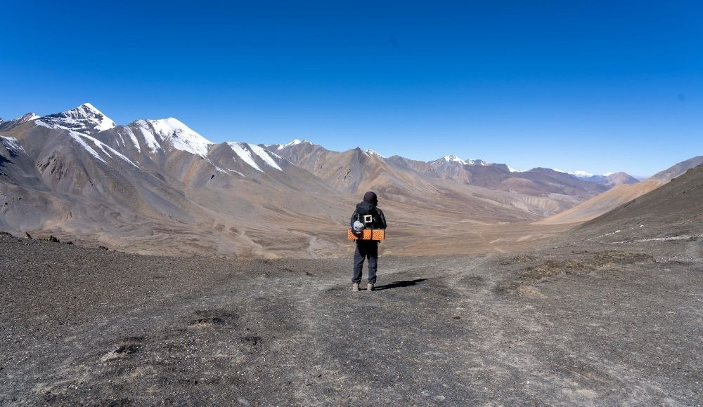
Early in the morning after breakfast, you will begin trekking towards Khola Camp. The trekking is mildly uphill and passes through Namduthan, Chhamdang, Tarako Sundo, Thamgaon Khola Dovan, and Phat reaching Kola Camp. The camping will be on the banks of Penjokhola confluence. It takes about 7 hours to reach Khola Camp from Tinje and offers a wonderful experience. Overnight stay will be in the banks of Khola Camp.
|
Starting Point |
Tinje [4110 m/13484 ft] |
|
Ending Point |
Khola Camp [4480 m/ 14698 ft] |
|
Connectivity |
No |
|
Trek Distance |
16 KM |
|
Trek Time |
5-6 hours |
|
Highest Elevation |
Khola Camp [4480 m/ 14698 ft] |
|
Elevation Gain |
[370 m/121ft] |
|
Accommodation |
Camping |
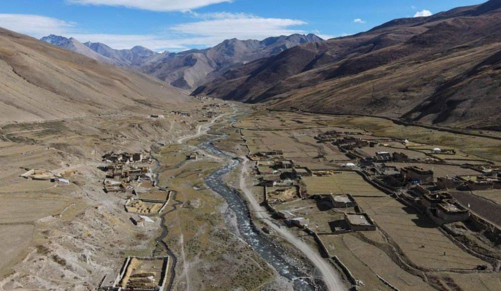
Early in the morning after breakfast, you will begin trekking towards Tokyu. You will cross a mountain pass today. Until the Chhoila Pass, the trek is mostly uphill and after crossing the pass, the downhill trek will begin. Trekking through the banks of Chhoila Khola, you will reach Tokyu. This day, you will trek for about 6 hours to reach Tokyu. Overnight stay in a camp at Tokyu.
|
Starting Point |
Khola Camp [4480 m/ 14698 ft] |
|
Ending Point |
Tokyu [4240 m/13910 ft] |
|
Connectivity |
Phone |
|
Trek Distance |
15 KM |
|
Trek Time |
5-6 hours |
|
Mountain Pass |
Chhoila Pass [5040/16535 ft] |
|
Highest Elevation |
Chhoila Pass [5040/16535 ft] |
|
Elevation Gain |
[-240 m/-787 ft] |
|
Accommodation |
Camping |
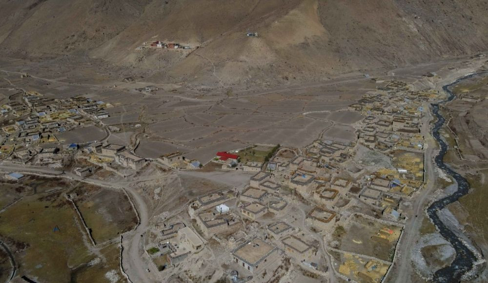
After breakfast, you will begin your trek. The trek passes through several gompas and small villages to reach Dho village. It takes about 3 hours to reach Dhotarap village. The trek is mildly downhill and the views are spectacular. The cliffs where the Yarsa is collected can be seen in the distance. This day, you will have good accessibility of phone and internet. In the evening, you will stay in a camp.
|
Starting Point |
Tokyu [4240 m/13910 ft] |
|
Ending Point |
Dho Tarap [3944 m/12939 ft] |
|
Connectivity |
Phone, Internet |
|
Trek Distance |
5 KM |
|
Trek Time |
5-6 hours |
|
Highest Elevation |
Tokyu [4240 m/13910 ft] |
|
Elevation Gain |
[-296 m/-971 ft] |
|
Accommodation |
Camping |
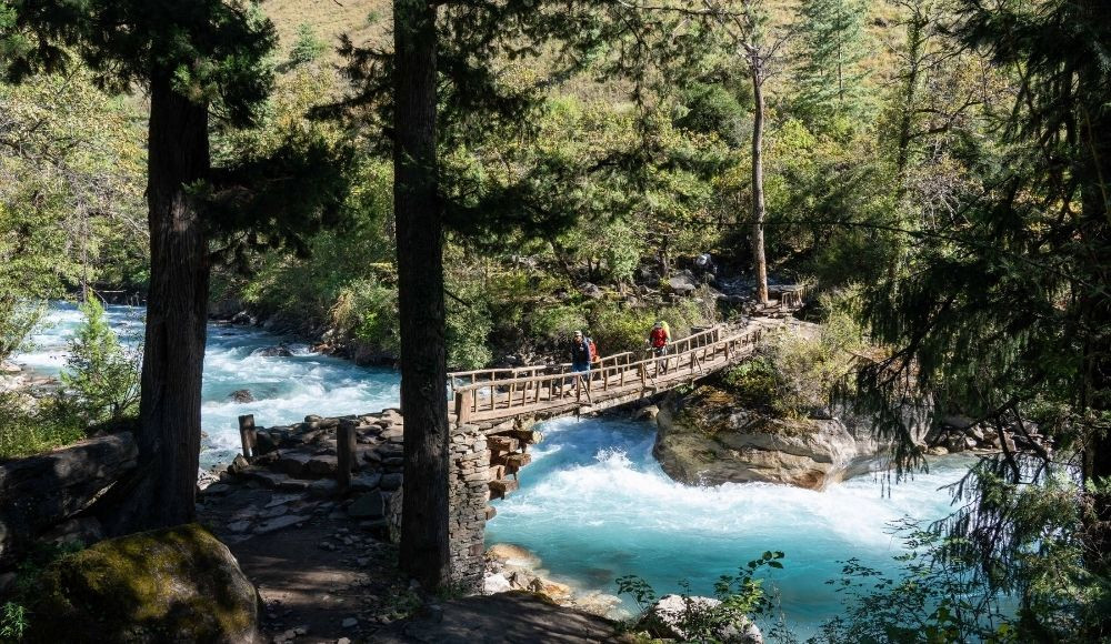
After breakfast in the morning, you will begin trekking towards the Toltol village. The trek this day is mostly downhill and easy than others in the higher areas. You will lose significant elevation this day reaching 3523 m at toltol. You will be trekking in the banks of Tarao Khola and the wooden bridges and forested trails are a wonderful part of the day. Overnight stay in the camp.
|
Starting Point |
Dho Tarap [3944 m/12939 ft] |
|
Ending Point |
Toltol [3523 m/11558 ft] |
|
Connectivity |
Phone |
|
Trek Distance |
18 KM |
|
Trek Time |
5-6 hours |
|
Highest Elevation |
Dho Tarap [3944 m/12939 ft] |
|
Elevation Gain |
[-421 m/-1381 ft] |
|
Accommodation |
Camping |
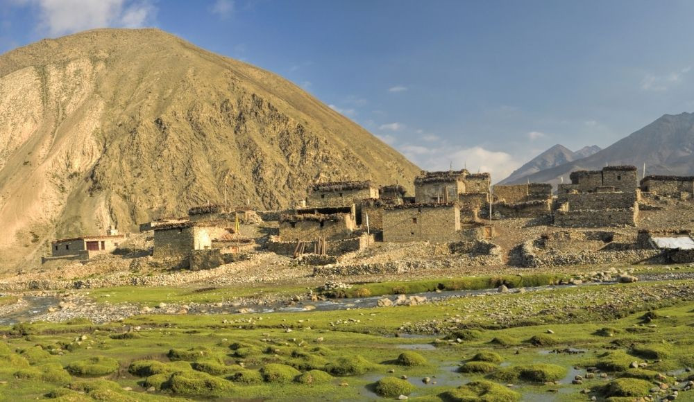
Early in the morning after breakfast in the camp, you will begin trekking towards Lasicap. The trail passes through Nawarpani, Chhyugar, Lamachaur, Laina Odar and Chhedhul Gompa from the banks of Tarap Khola taking you to the Lasicap village. Along the trail, you can explore several gompas, wooden bridges, cultural villages and monasteries. This day, you will lose altitude reaching an elevation of 2700 m above sea level from Toltol village. Overnight stay in a camp.
|
Starting Point |
Toltol [3523 m/11558 ft] |
|
Ending Point |
Laisicap [2775 m/9104 ft] |
|
Connectivity |
Phone |
|
Trek Distance |
18 KM |
|
Trek Time |
5-6 hours |
|
Highest Elevation |
Toltol [3523 m/11558 ft] |
|
Elevation Gain |
[-748 m/-2454 ft] |
|
Accommodation |
Camping |
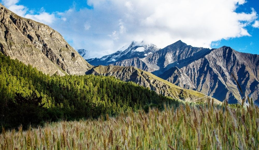
This day, you will lose elevation first and then climb uphill to reach Dunai from Lasicap. Trekking in the banks of the Thuli Bheri River and passing through several villages such as Tarakot, Lingdo, Lawan, Byasgad and Palchekhola will take you to this beautiful Dunai village. This day you can explore several gompas and monasteries, and cultural villages in some parts of the trail. Though this day, you will trek long distances, it is easier than other higher elevation treks. So, you can cover quite a good distance during the trek. In the evening, you can explore the village and the landscapes around. This day, after a long time, you will stay in the teahouse in Dunai.
|
Starting Point |
Lasicap [2775 m/9104 ft] |
|
Ending Point |
Dunai [2140 m/7020 ft] |
|
Connectivity |
Phone |
|
Trek Distance |
22 KM |
|
Trek Time |
5-6 hours |
|
Highest Elevation |
Lasicap [2775 m/9104 ft] |
|
Elevation Gain |
[-635 m/-2083 ft] |
|
Accommodation |
Teahouse |
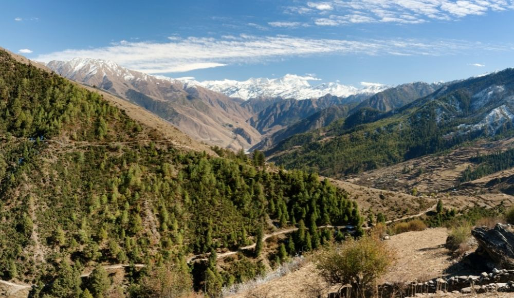
This is the last day of the Upper Mustang Circuit Trek. After breakfast in the morning, you will begin trekking from Dunai to Juphal. You will pass through several villages such as Rupgad, Kalagauda, Paranga, Dangidwar and Motipur before reaching Dunai. This day, the trek is mildly uphill and adventurous. Also, you will get an opportunity to explore the village lifestyle. And after a long time, you will witness the people around. It takes about 6 hours of trekking to reach Juphal from Dunai. Alternatively, if you want to explore the drive option, it will be arranged since it’s accessible from Dunai to reach Juphal. Overnight stay in a teahouse in Juphal.
|
Starting Point |
Dunai [2140 m/7020 ft] |
|
Ending Point |
Juphal [2475 m/8120 ft] |
|
Connectivity |
Phone |
|
Trek Distance |
11 KM |
|
Trek Time |
5-6 hours |
|
Highest Elevation |
Juphal [2475 m/8120 ft] |
|
Elevation Gain |
[335 m/1099 ft] |
|
Accommodation |
Teahouse |
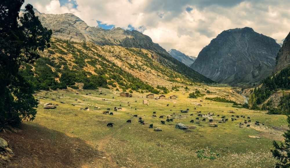
Finally, on the last day, an early flight from Juphal will take you back to Nepalgunj. In Nepalgunj, you can explore the suburbs and the culture of western Nepal. Trying some eateries sound like a boon after such a long-distance trek. Another flight from Nepalgunj will take you back to the Kathmandu valley. The flight to Kathmandu from Nepalgunj concludes the trek. However, the memories and photographs you have collected during the trek last a lifetime and forever stay a memoir of achievement.
Trip Cost |
||
|
Minimum no. of PAX |
Package Cost |
Departure Date |
|
6-8 PAX |
NPR 99000 Per Person |
6th May 2022 2nd Sept. 2022 |
Meal is essential during the trek that is prepared by our supporting staff. The meals are prepared in the camp and served to the trekkers according to the availability of meals in the rural areas. The fuels, goods and raw meals are carried by mules and porters for the trek. In the morning, the basic breakfast will be prepared by our proficient mountain cook. Similarly, lunch and dinner will be provided. The basic meal list for this camping trek is provided below.
|
Camping Food List |
|
|
Breakfast |
|
|
Meals (Lunch/Dinner) |
|
|
Snacks |
|
Upper Dolpo Circuit Trek for Nepali is very doable and cost-efficient. Though the amount sounds expensive, the experience you get is very worth it and offers joy for a lifetime. For Upper Dolpo Circuit Trek, you need to have good gear and camping equipment. Having good gear ensures safety and comfort in the strange mountain, where finding a village is not only difficult, it is rare too.
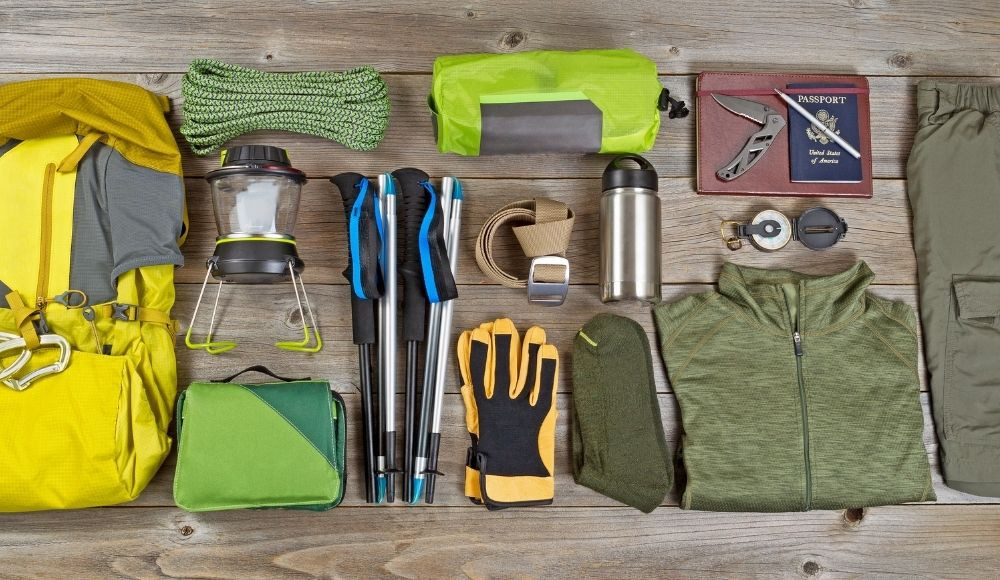
Unlike other trekking areas as in Everest and Annapurna region, Dolpo is demanding and quite difficult. It requires a lot of preparation and good technical support to complete. It is a camping trek, so, in most of the places, you will be camping. The wild and vivid experience of Dolpo is tiresome but a memorable one.
To trek in the Dolpo area, you need to have good gear. For the backpacking list, please refer to our Nepal Trekking Gear Checklist.The Upper Dolpo Circuit trek is a difficult but rewarding trek in the remote mountains of Nepal. While planning a trek to the Dolpo area, always keep in mind that, there will be some instances where you might feel exhausted physically. It requires trekking over the elevations of 5000 m., so chances of Altitude Sickness are high. People with a moderate level of physical fitness and fine health can complete the trek easily. Some tips to mitigate difficulty are:-
The best time to visit Upper Dolpo for trekking is during April and May, and September and October. During these months, there are fewer chances of snowfall and rainfall. The weather is quite dry and the temperature is adaptable. So, it is a good time to explore Upper Dolpo Circuit during April, May, September and October months.
Since the Upper Dolpo Circuit trek is an extensive three weeks of planning, which is quite a long time, getting there is a favourable month is important. Otherwise, the harsh climate can deter the experience and it will be difficult in the higher mountain terrains.
Getting Dolpa is easy but trekking in the Dolpo area is extensive. A flight from Kathmandu to Nepalgunj and another flight from Nepalgunj to Juphal can easily get you to the Dolpa district. But if you want to explore the Shey Phoksundo Lake and Upper Dolpo area, the only option you have is trekking.
Dolpa is the biggest district in Nepal. It has an area of 7889 sq. Km which is 5.36% of the total landmass of Nepal.
The months of April, May, September and October are the best time to visit Upper Dolpa for trekking. During these months, the weather is moderate and the climate is favourable for trekking activity. Also, due to the clear visibility, you can explore the best landscapes of Dolpo.